MyTopo
Skeels Michigan US Topo Map
Couldn't load pickup availability
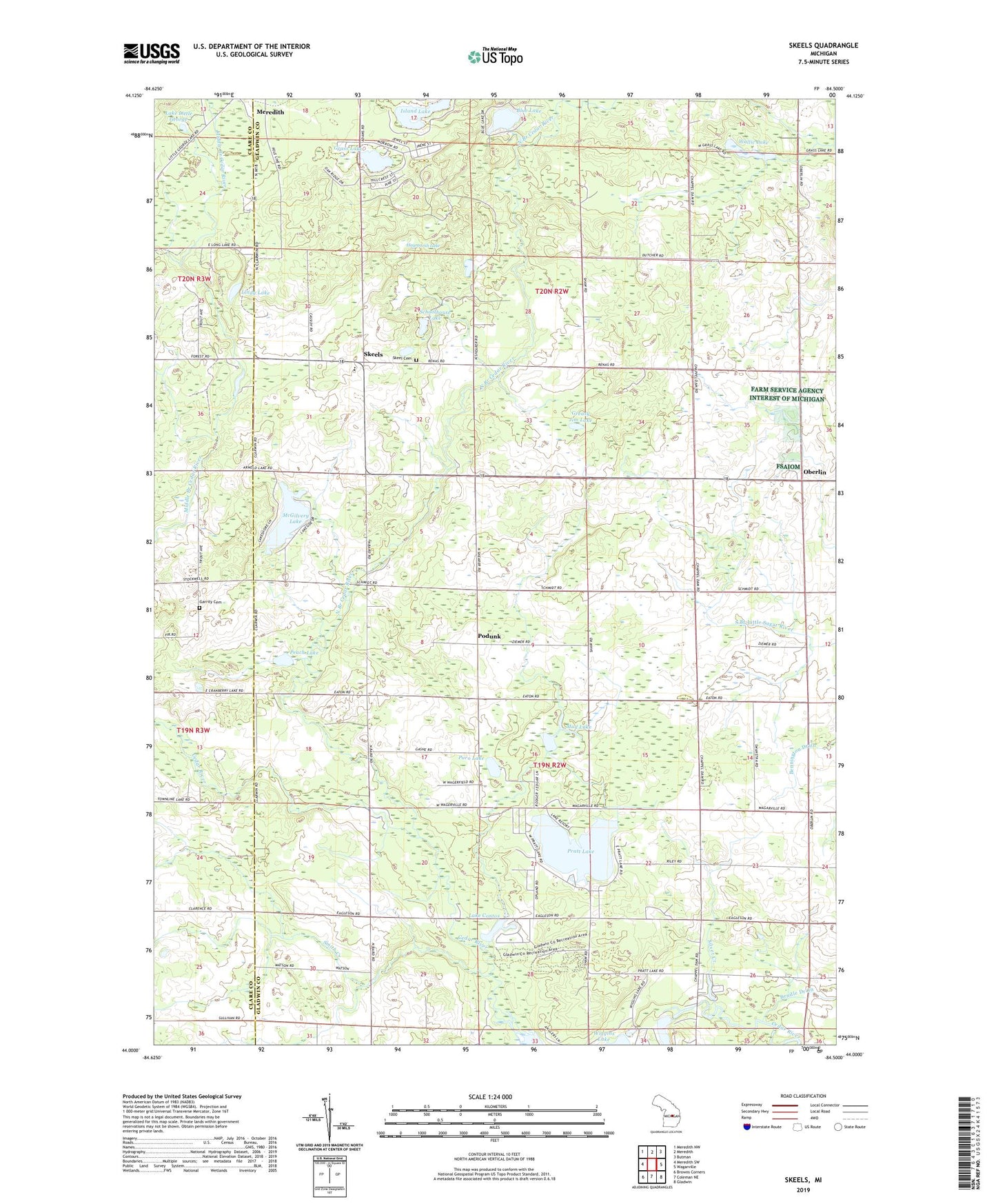
2023 topographic map quadrangle Skeels in the state of Michigan. Scale: 1:24000. Based on the newly updated USGS 7.5' US Topo map series, this map is in the following counties: Gladwin, Clare. The map contains contour data, water features, and other items you are used to seeing on USGS maps, but also has updated roads and other features. This is the next generation of topographic maps. Printed on high-quality waterproof paper with UV fade-resistant inks.
Quads adjacent to this one:
West: Meredith SW
Northwest: Meredith NW
North: Meredith
Northeast: Butman
East: Wagarville
Southeast: Gladwin
South: Coleman NE
Southwest: Browns Corners
This map covers the same area as the classic USGS quad with code o44084a5.
Contains the following named places: Blue Lake, Chappel Dam, Christ Centered Church, Emmanuel Baptist Church, Garrity Cemetery, Gladwin County Recreation Area, Grace Fellowship Church, Grass Lake, Greasy Jim Lake, Haymarsh Lake, Island Lake, Lake Contos, Lake Little George, Lindy Lake, McGilvery Lake, Mud Lake, North Branch Cedar River, Oberlin, Oberlin Post Office, Peach Lake, Podunk, Pratt Lake, Puro Lake, Schoolhouse Lake, Silver Creek, Skeel Cemetery, Skeels, Skeels Northern Christian School, Skeels Oil Field, Skeels Post Office, Smith Creek, Township of Sage, Township of Sherman, Wallic Lake