MyTopo
Burlington Michigan US Topo Map
Couldn't load pickup availability
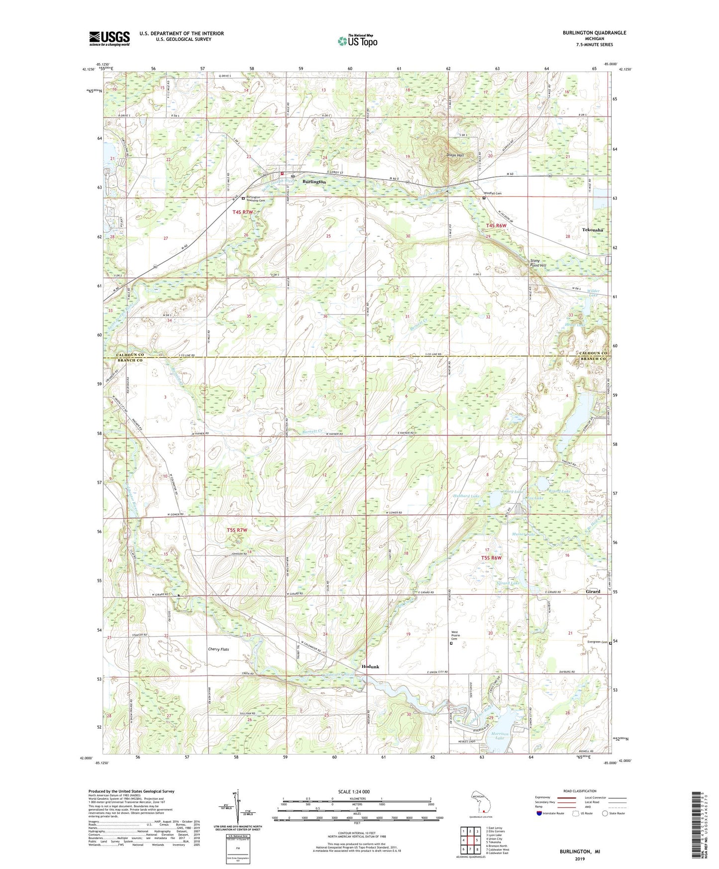
2023 topographic map quadrangle Burlington in the state of Michigan. Scale: 1:24000. Based on the newly updated USGS 7.5' US Topo map series, this map is in the following counties: Branch, Calhoun. The map contains contour data, water features, and other items you are used to seeing on USGS maps, but also has updated roads and other features. This is the next generation of topographic maps. Printed on high-quality waterproof paper with UV fade-resistant inks.
Quads adjacent to this one:
West: Union City
Northwest: East Leroy
North: Ellis Corners
Northeast: Lyon Lake
East: Tekonsha
Southeast: Coldwater East
South: Coldwater West
Southwest: Bronson North
This map covers the same area as the classic USGS quad with code o42085a1.
Contains the following named places: Angel Cove Park, Bell School, Bidwell School, Burlington, Burlington Post Office, Burlington Station, Burlington Township Cemetery, Burlington Township Fire Department, Burlington Township Library, Cherry Flats, Church of God, Cobblestone School, Craig Lake, Dixon Hall, Dow Lake, Evergreen Cemetery, Fox Lake, Girard, Girard Lake, Girard Post Office, Hayner School, Heart Lake, Hodunk, Hodunk Pond, Hodunk Post Office, Hog Creek, Hubbard Lake, Kaufmans Landing Strip, Meserole School, Methodist Episcopal Church, Methodist Episcopal Church Historical Marker, Morey School, Musser Lake, North Branch Hog Creek, Olney Lake, Plains School, Pork Barrel Lake, Powatomie Recreation Area Campground, Riverbend County Park, Round Lake, Seventh Day Adventist Church, Sisco School, South Branch Hog Creek, Stancers Pond, Stony Point Hill, Township of Burlington, Township of Girard, Township of Tekonsha, Township of Union, Turtle Creek Golf Course, Van Shoick School, Village of Burlington, Vincent Lake, West Prairie Cemetery, Wilder Lake, Windfall Cemetery, Windfall School, ZIP Code: 49094