MyTopo
Tekonsha Michigan US Topo Map
Couldn't load pickup availability
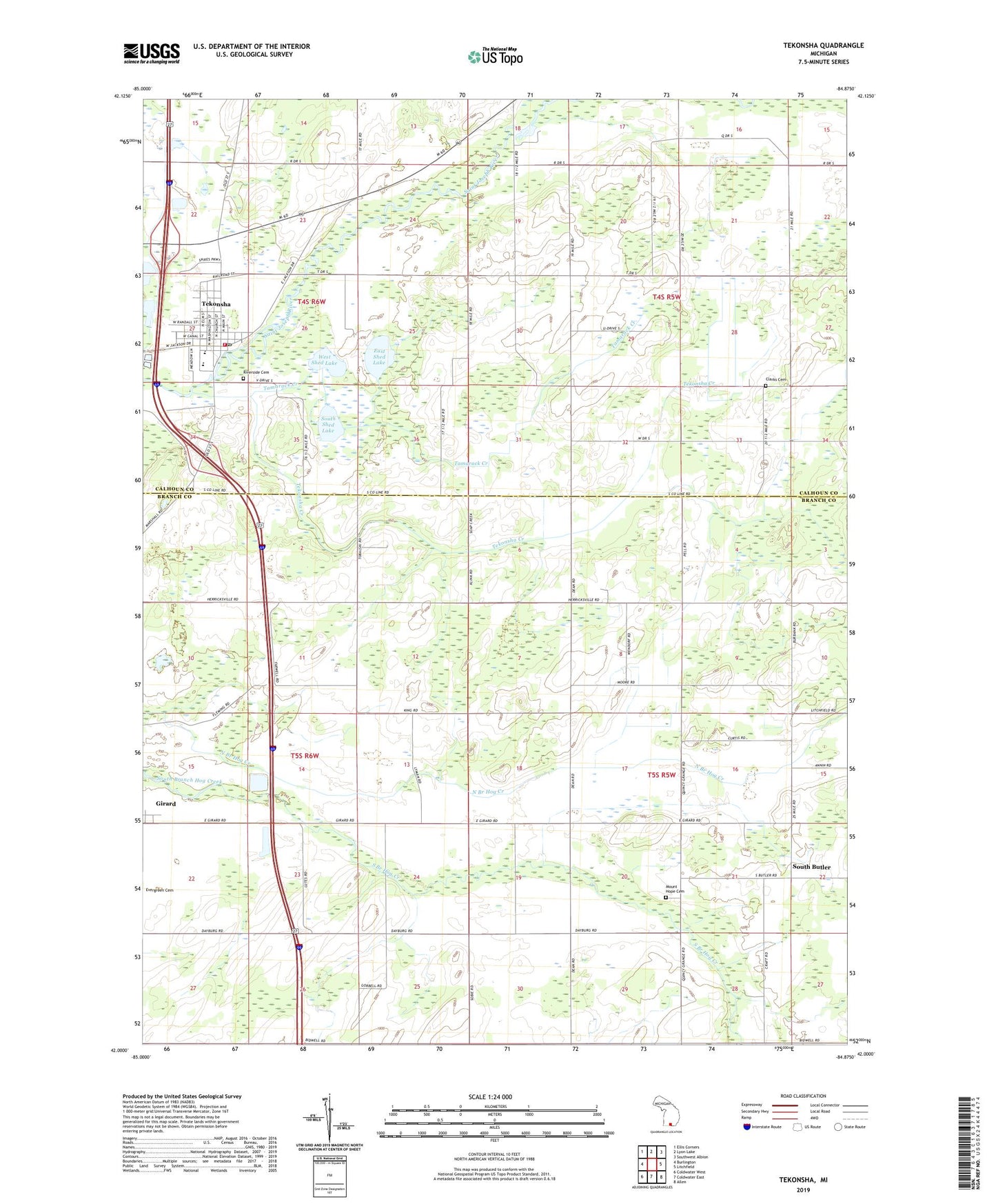
2023 topographic map quadrangle Tekonsha in the state of Michigan. Scale: 1:24000. Based on the newly updated USGS 7.5' US Topo map series, this map is in the following counties: Branch, Calhoun. The map contains contour data, water features, and other items you are used to seeing on USGS maps, but also has updated roads and other features. This is the next generation of topographic maps. Printed on high-quality waterproof paper with UV fade-resistant inks.
Quads adjacent to this one:
West: Burlington
Northwest: Ellis Corners
North: Lyon Lake
Northeast: Southwest Albion
East: Litchfield
Southeast: Allen
South: Coldwater East
Southwest: Coldwater West
This map covers the same area as the classic USGS quad with code o42084a8.
Contains the following named places: Cheney Park, Clarks Cemetery, Dayburg Church, East Shed Lake, Faxon Post Office, Harvey Randall House Historical Marker, Juddville United Methodist Church, Marshall Fire Fighters Ambulance Service Tekonsha, Mount Hope Cemetery, Riverside Cemetery, South Butler, South Butler Post Office, South Shed Lake, Tamarack Creek, Tekonsha, Tekonsha Creek, Tekonsha Fire Department, Tekonsha High School, Tekonsha Post Office, Tekonsha Station, Tekonsha Township Library, Tekonsha Village Police Department, Township of Butler, Township of Clarendon, Village of Tekonsha, West Shed Lake, WNWN-FM (Coldwater), ZIP Code: 49092