MyTopo
Lyon Lake Michigan US Topo Map
Couldn't load pickup availability
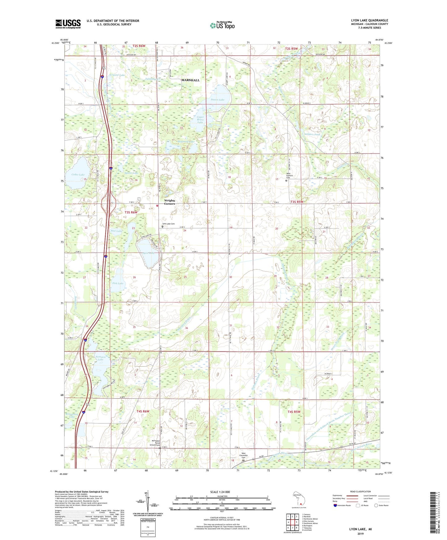
2023 topographic map quadrangle Lyon Lake in the state of Michigan. Scale: 1:24000. Based on the newly updated USGS 7.5' US Topo map series, this map is in the following counties: Calhoun. The map contains contour data, water features, and other items you are used to seeing on USGS maps, but also has updated roads and other features. This is the next generation of topographic maps. Printed on high-quality waterproof paper with UV fade-resistant inks.
Quads adjacent to this one:
West: Ellis Corners
Northwest: Ceresco
North: Marshall
Northeast: Northwest Albion
East: Southwest Albion
Southeast: Litchfield
South: Tekonsha
Southwest: Burlington
This map covers the same area as the classic USGS quad with code o42084b8.
Contains the following named places: Cedar Lake, Cedar Lake Post Office, Clarendon and Eckford Drain Number Three, Crystal Lake, Eaton Proving Grounds, Fish Lake, Fredonia Township Fire Department, Goose Pond Drain, Huckleberry Drain, Klingaman Lake, Little Polly Church, Long Lake, Lyon Lake, Lyon Lake Cemetery, Lyon Lake Church, Lyon Lake Post Office, Maple Grove Church, Marshall Country Club, Maynard Lake, McFadden Burial Ground Cemetery, Mud Lake, Nottawa Drain, Nottawa Lake, Pine Lake, Squaw Lake, Squaw Lake Drain, Stuart Lake, Township of Eckford, Upper Brace Lake, West Clarendon Cemetery, West Eckford Cemetery, West Eckford Church, Westwinds Campground, Wilders Pond, Wilders Station, Wilderville Post Office, Wrights Corners