MyTopo
Cadillac North Michigan US Topo Map
Couldn't load pickup availability
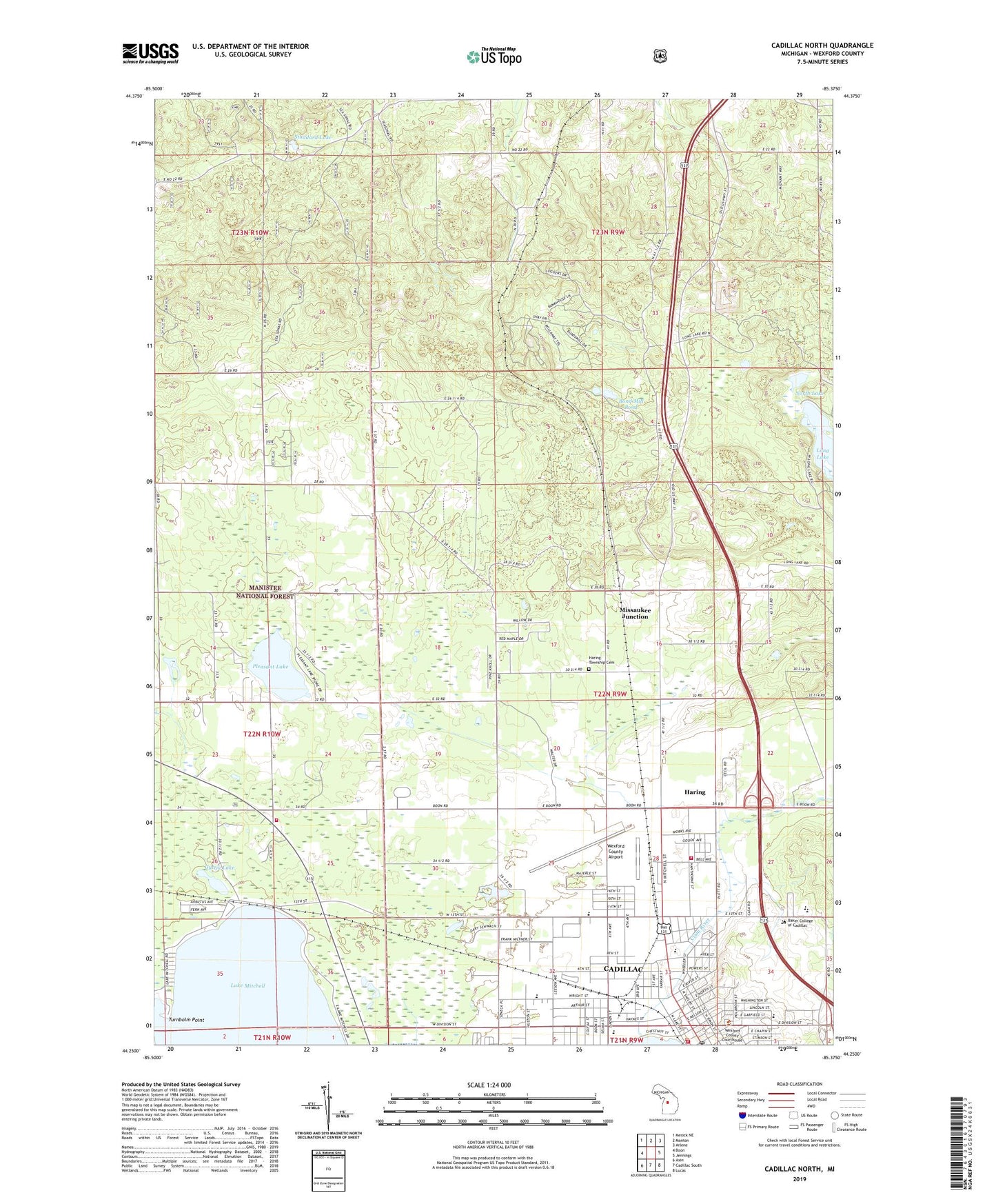
2019 topographic map quadrangle Cadillac North in the state of Michigan. Scale: 1:24000. Based on the newly updated USGS 7.5' US Topo map series, this map is in the following counties: Wexford. The map contains contour data, water features, and other items you are used to seeing on USGS maps, but also has updated roads and other features. This is the next generation of topographic maps. Printed on high-quality waterproof paper with UV fade-resistant inks.
Quads adjacent to this one:
West: Boon
Northwest: Mesick NE
North: Manton
Northeast: Arlene
East: Jennings
Southeast: Lucas
South: Cadillac South
Southwest: Axin
Contains the following named places: Baker College of Cadillac, Ballou Post Office, Bethel Chapel, Bond Mill Pond, Bond's Mills Post Office, Cadillac, Cadillac Assembly of God Church, Cadillac Carnegie Library Historical Marker, Cadillac Christian Reformed Church, Cadillac Fire Department, Cadillac First Church of the Nazarene, Cadillac High School, Cadillac Junior High School, Cadillac Police Department, Cadillac Post Office, Cadillac Seventh Day Adventist Church, Cadillac Station, Cadillac United Methodist Church, Cass School, Charles T Mitchell House Historical Marker, Charter Township of Haring, Church of Christ, Community of Christ Church, Crown of Life Lutheran Church, Diggins Park, Evergreen Baptist Church, Faith Baptist Church, Family Practice of Cadillac, First Church of God, First Congregational Church, First Covenant Church, First Presbyterian Church, Fresh Annointing Church of God, Gyttja Lake, Haring, Haring Census Designated Place, Haring Charter Township Cemetery, Haring Post Office, Haring Station, Haring Township Fire Department, Harvest Worship Center, Hawk Golf Course, Heritage Christian School, Independent Bible Church, Kingdom Hall, Kingdom Hall of Jehovah's Witnesses, Lincoln School, Long Lake Campground, McKinley School, Missaukee Junction, Missaukee Junction Station, New Hope Christian Church, North Lake, Northern District Fairgrounds, Old US-131 State Forest Campground, Pleasant Lake, Pleasant Lake Chapel, Pleasant Lake School, Resurrection Life Church, Saint Ann Church, Saint Ann School, Saint Mary's Episcopal Church, Selma School, Selma Township Fire Department, Selma Township Hall, Seventh Day Adventist School, South Gilbert School, Stoddard Lake, Temple Hill Baptist Church, Turnbolm Point, Wexford County Airport, Wexford County Courthouse, Wexford County Historical Society Museum, Wexford County Sheriff's Office, Wexford-Missaukee Intermediate School, White Pine School