MyTopo
Lucas Michigan US Topo Map
Couldn't load pickup availability
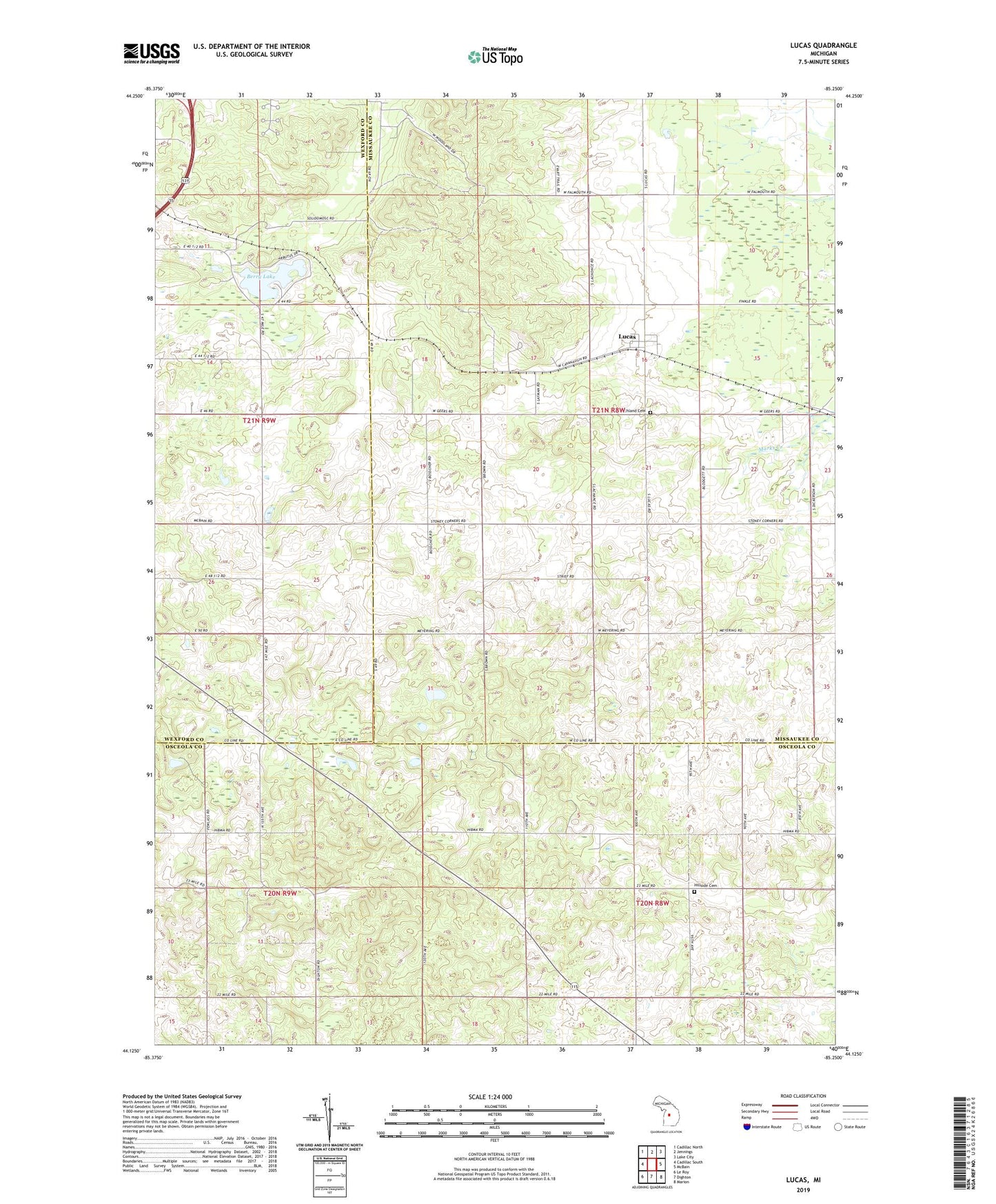
2023 topographic map quadrangle Lucas in the state of Michigan. Scale: 1:24000. Based on the newly updated USGS 7.5' US Topo map series, this map is in the following counties: Missaukee, Osceola, Wexford. The map contains contour data, water features, and other items you are used to seeing on USGS maps, but also has updated roads and other features. This is the next generation of topographic maps. Printed on high-quality waterproof paper with UV fade-resistant inks.
Quads adjacent to this one:
West: Cadillac South
Northwest: Cadillac North
North: Jennings
Northeast: Lake City
East: McBain
Southeast: Marion
South: Dighton
Southwest: Le Roy
This map covers the same area as the classic USGS quad with code o44085b3.
Contains the following named places: Berry Lake, Bosscher School, Cadillac Lookout Tower, Cadillac Woods Campground, Elton Post Office, Highland, Hillside Cemetery, Hollister School, Lucas, Lucas Christian Reformed Church, Lucas Post Office, Lucas Station, Lucas-McBain School, Rehoboth Reformed Church, Richland Cemetery, School Number 1, South Community Church, Stoney Corner, Township of Richland, WCMV-TV (Cadillac), WGKI-TV (Cadillac), WKJF-FM (Cadillac), WWLZ-FM (Cadillac), WWTV-TV (Cadillac), WYTW-FM (Cadillac)