MyTopo
Jennings Michigan US Topo Map
Couldn't load pickup availability
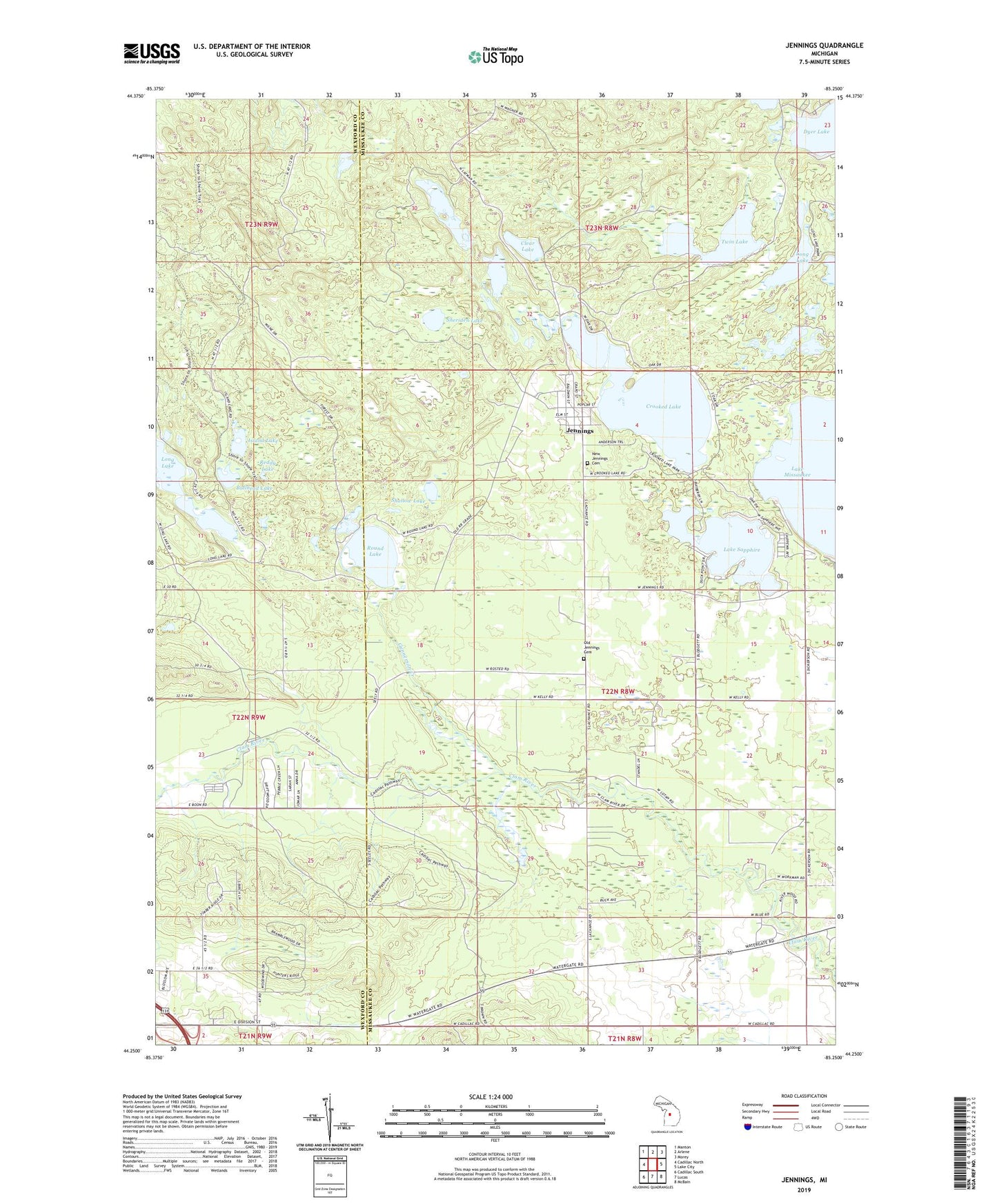
2023 topographic map quadrangle Jennings in the state of Michigan. Scale: 1:24000. Based on the newly updated USGS 7.5' US Topo map series, this map is in the following counties: Missaukee, Wexford. The map contains contour data, water features, and other items you are used to seeing on USGS maps, but also has updated roads and other features. This is the next generation of topographic maps. Printed on high-quality waterproof paper with UV fade-resistant inks.
Quads adjacent to this one:
West: Cadillac North
Northwest: Manton
North: Arlene
Northeast: Morey
East: Lake City
Southeast: McBain
South: Lucas
Southwest: Cadillac South
This map covers the same area as the classic USGS quad with code o44085c3.
Contains the following named places: Bullhead Lake, Clear Lake, Crooked Lake, Crooked Lake Park, Dyer Lake, Emmanuel Lutheran Church, Gunnerson Creek, Island Lake, Jennings, Jennings Census Designated Place, Jennings Post Office, Lake Julia, Lake Sapphire, Lake Township Hall, Long Lake, Long Lake State Forest Campground, Mud Lake, New Jennings Cemetery, Old Jennings Cemetery, Reddy Lake, Round Lake, Round Lake Post Office, Shallow Lake, Sheriden Lake, Spring Lake, Township of Lake, Twin Lake, Twin Lakes, Whitlock Lake, Whitlock Lake Campground