MyTopo
Capac Michigan US Topo Map
Couldn't load pickup availability
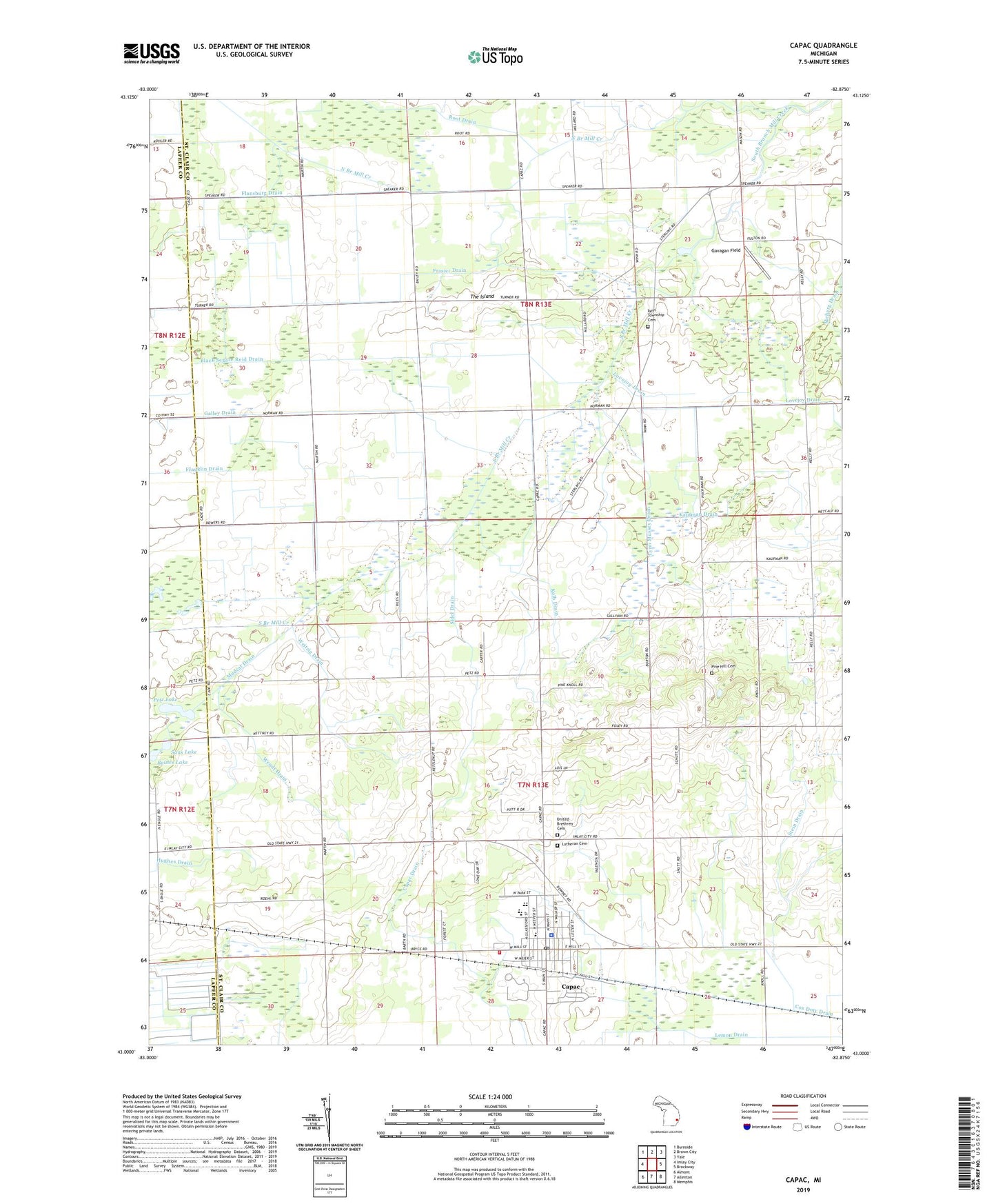
2019 topographic map quadrangle Capac in the state of Michigan. Scale: 1:24000. Based on the newly updated USGS 7.5' US Topo map series, this map is in the following counties: St. Clair, Lapeer. The map contains contour data, water features, and other items you are used to seeing on USGS maps, but also has updated roads and other features. This is the next generation of topographic maps. Printed on high-quality waterproof paper with UV fade-resistant inks.
Quads adjacent to this one:
West: Imlay City
Northwest: Burnside
North: Brown City
Northeast: Yale
East: Brockway
Southeast: Memphis
South: Allenton
Southwest: Almont
Contains the following named places: Baines Lake, Black Segate Reid Drain, Capac, Capac Community Museum, Capac Elementary School, Capac High School, Capac Library, Capac Middle School, Capac Police Department, Capac Post Office, Capac Station, Deer View Golf Club, First Baptist Church of Capac, First United Methodist Church, Flansburg Drain, Franklin Drain, Frasier Drain, Galley Drain, Gavagan Field, Kaufman Drain, Kolb Drain, Lemon Drain, Lynn Corner School, Lynn Mussey Drain, Lynn Post Office, Lynn Township Cemetery, Mercy Family Care, Mudcat Drain, Mussey Township Cemetery, Mussey Township Fire Department, North Branch Mill Creek, Petz Lake, Pine Hill Cemetery, Root Drain, Saint John's Lutheran Church, Saint Nicholas Catholic Church, Sans Lake, Sidel Drain, South Branch Mill Creek, Stein Drain, The Island, Township of Lynn, Township of Mussey, Tri - Hospital Emergency Medical Services Station 7, United Brethren Cemetery, United Brethren Church, Village of Capac, Weitzig Drain, Wendt Drain, ZIP Code: 48014