MyTopo
Brown City Michigan US Topo Map
Couldn't load pickup availability
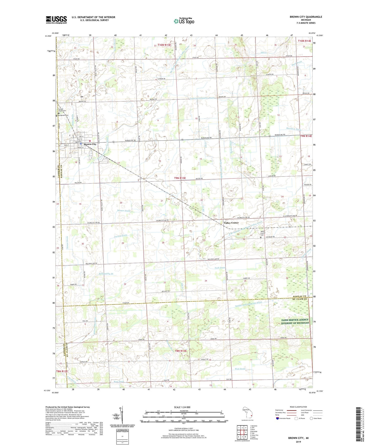
2023 topographic map quadrangle Brown City in the state of Michigan. Scale: 1:24000. Based on the newly updated USGS 7.5' US Topo map series, this map is in the following counties: Sanilac, St. Clair, Lapeer. The map contains contour data, water features, and other items you are used to seeing on USGS maps, but also has updated roads and other features. This is the next generation of topographic maps. Printed on high-quality waterproof paper with UV fade-resistant inks.
Quads adjacent to this one:
West: Burnside
Northwest: Marlette
North: Juhl
Northeast: Peck
East: Yale
Southeast: Brockway
South: Capac
Southwest: Imlay City
This map covers the same area as the classic USGS quad with code o43082b8.
Contains the following named places: Brown City, Brown City Banner Historical Marker, Brown City Community School, Brown City Community Schools Historical Marker, Brown City Family Health Care, Brown City Fire Department, Brown City Hall, Brown City Health Center, Brown City Police Department, Brown City Post Office, Brown City Public Library, Brown City Station, Brown City United Methodist Church, City of Brown City, Drennan School, Evergreen Cemetery, Faith Baptist Church, Hill School, Hydorn Drain, Immanuel Revival Church, Kenney Drain, Lapeer and Sanilac Drain, Macklem Drain, Mapleview Estates Mobile Home Park, Mennonite Church, Missionary Church, Odelville School, Sacred Heart Catholic Church, Sacred Heart Cemetery, Scott Drain, Sharpsville Post Office, Sharpsville School, Toman Drain, Township of Maple Valley, Trinity Lutheran Church, Valley Center, Valley Center Cemetery, Valley Center Drain, Valley Center Post Office, Valley Center School, Valley Center Station, Varney Drain, Wait Drain, Willoughby Branch, Willoughby Drain, Winters Drain, Witmer Drain, York Drain, ZIP Code: 48416