MyTopo
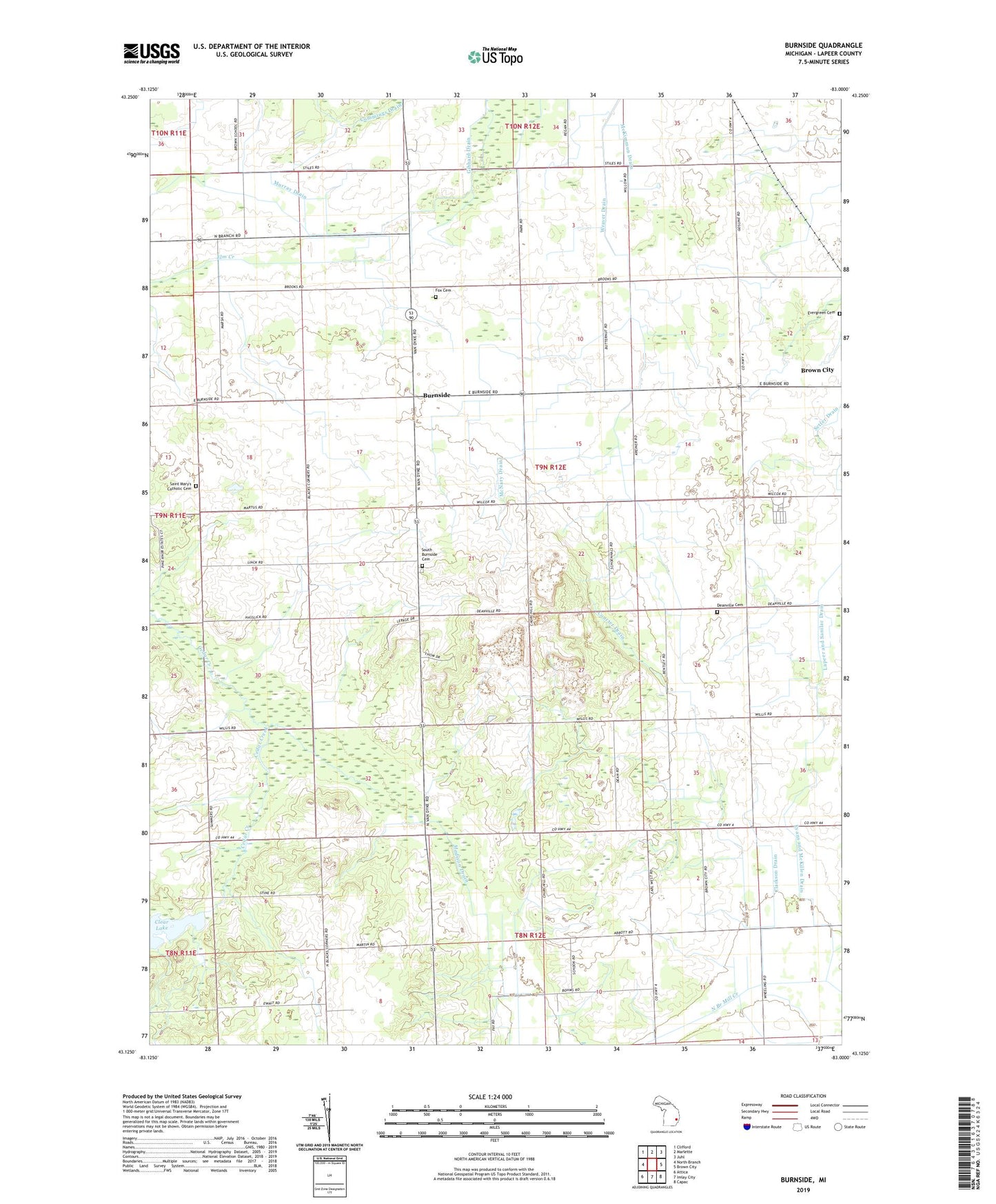
Burnside Michigan US Topo Map
Couldn't load pickup availability
2023 topographic map quadrangle Burnside in the state of Michigan. Scale: 1:24000. Based on the newly updated USGS 7.5' US Topo map series, this map is in the following counties: Lapeer. The map contains contour data, water features, and other items you are used to seeing on USGS maps, but also has updated roads and other features. This is the next generation of topographic maps. Printed on high-quality waterproof paper with UV fade-resistant inks.
Quads adjacent to this one:
West: North Branch
Northwest: Clifford
North: Marlette
Northeast: Juhl
East: Brown City
Southeast: Capac
South: Imlay City
Southwest: Attica
This map covers the same area as the classic USGS quad with code o43083b1.
Contains the following named places: Abbott School, Burnside, Burnside Post Office, Clarkson Drain, Clear Lake, Clear Lake School, Courter Drain, Cummings Drain, Deanville Cemetery, Deanville Post Office, Deanville School, Evans and McKillen Drain, Evergreen Cemetery, Fox Cemetery, Gibbard Drain, Index Post Office, Index Station, Madison Drain, McKimmon Drain, McNary Drain, Murray Drain, Murray Farms, Muxlow Dairy Farm, North Goodland Church, R D R Dairy Farms, Saint Mary's Catholic Cemetery, Saint Marys Church, South Burnside Cemetery, Township of Burnside, United Brethren Church, United Missionary Church, Weaver Drain