MyTopo
Carp River East Michigan US Topo Map
Couldn't load pickup availability
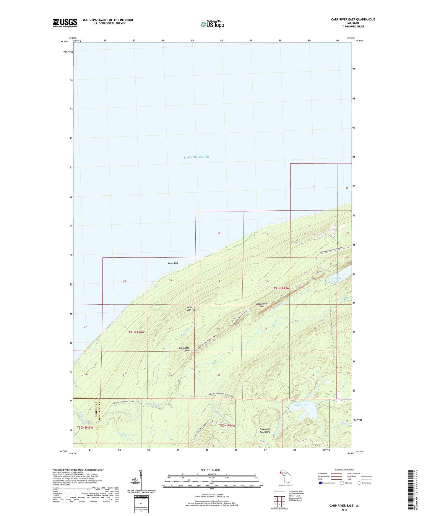
2019 topographic map quadrangle Carp River East in the state of Michigan. Scale: 1:24000. Based on the newly updated USGS 7.5' US Topo map series, this map is in the following counties: Ontonagon, Gogebic. The map contains contour data, water features, and other items you are used to seeing on USGS maps, but also has updated roads and other features. This is the next generation of topographic maps. Printed on high-quality waterproof paper with UV fade-resistant inks.
Quads adjacent to this one:
West: Carp River West
East: Government Peak
Southeast: Aldridge Creek
South: Underwood Hill
Southwest: Tiebel Creek
Contains the following named places: Big Carp Falls, Buckshot Landing, Green Mountain Peak, Konteka Creek, LaFayette Landing, LaFayette Mine, LaFayette Peak, Landlookers Creek, Lone Rock, Mirror Lake, Miscowawbic Peak, Porcupine Mountains, Scott Creek, Shining Cloud Falls, Trail Creek, Washington Creek