MyTopo
Tiebel Creek Michigan US Topo Map
Couldn't load pickup availability
Also explore the Tiebel Creek Forest Service Topo of this same quad for updated USFS data
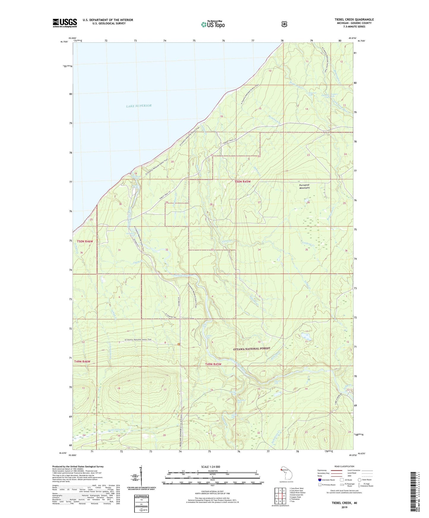
2023 topographic map quadrangle Tiebel Creek in the state of Michigan. Scale: 1:24000. Based on the newly updated USGS 7.5' US Topo map series, this map is in the following counties: Gogebic. The map contains contour data, water features, and other items you are used to seeing on USGS maps, but also has updated roads and other features. This is the next generation of topographic maps. Printed on high-quality waterproof paper with UV fade-resistant inks.
Quads adjacent to this one:
West: Black River Harbor
North: Carp River West
Northeast: Carp River East
East: Underwood Hill
Southeast: Tula
South: Thomaston
Southwest: Copper Peak
This map covers the same area as the classic USGS quad with code o46089f8.
Contains the following named places: Abinodji Falls, Cardinal Creek, Copper Creek, Explorers Falls, Gipsy Creek, Iagoo Falls, Kenabeek Creek, Ledge Creek, Lepisto Falls, Lookout Creek, Manabezho Falls, Manido Falls, Memengwa Creek, Nawadaha Falls, Nokomis Falls, Ogima Falls, Ogimakwe Falls, Peboan Creek, Pinkerton Creek, Pinkerton Falls, Preque Isle State Campground, Presque Isle Park, Presque Isle River, Sahwa Creek, Speaker Creek, Tiebel Creek, Trappers Falls