MyTopo
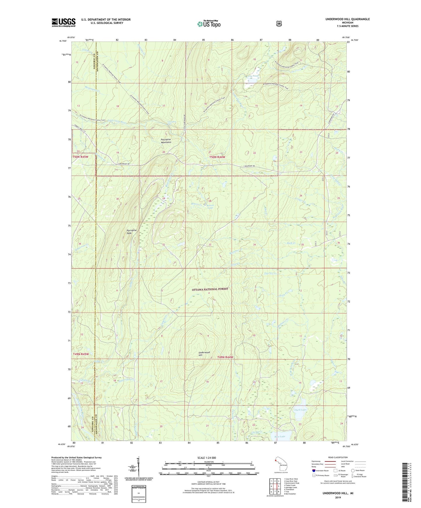
Underwood Hill Michigan US Topo Map
Couldn't load pickup availability
Also explore the Underwood Hill Forest Service Topo of this same quad for updated USFS data
2023 topographic map quadrangle Underwood Hill in the state of Michigan. Scale: 1:24000. Based on the newly updated USGS 7.5' US Topo map series, this map is in the following counties: Ontonagon, Gogebic. The map contains contour data, water features, and other items you are used to seeing on USGS maps, but also has updated roads and other features. This is the next generation of topographic maps. Printed on high-quality waterproof paper with UV fade-resistant inks.
Quads adjacent to this one:
West: Tiebel Creek
Northwest: Carp River West
North: Carp River East
Northeast: Government Peak
East: Aldridge Creek
Southeast: Merriweather
South: Tula
Southwest: Thomaston
This map covers the same area as the classic USGS quad with code o46089f7.
Contains the following named places: Bass Lake, Beaver Creek, Beaver Lake, Bessemer Creek, Blowdown Creek, Buck Creek, Canyon Creek, Clark Lake, Crowned Creek, Doe Creek, Eden Creek, Greenstone Falls, Lily Pond, Porcupine Peak, Redstart Creek, Section 17 Cabin, Song Creek, Sooty Creek, Summit Peak, Texas Creek, Towhee Creek, Underwood Hill, Underwood Lookout Tower, Vesper Creek, Wabeno Creek