MyTopo
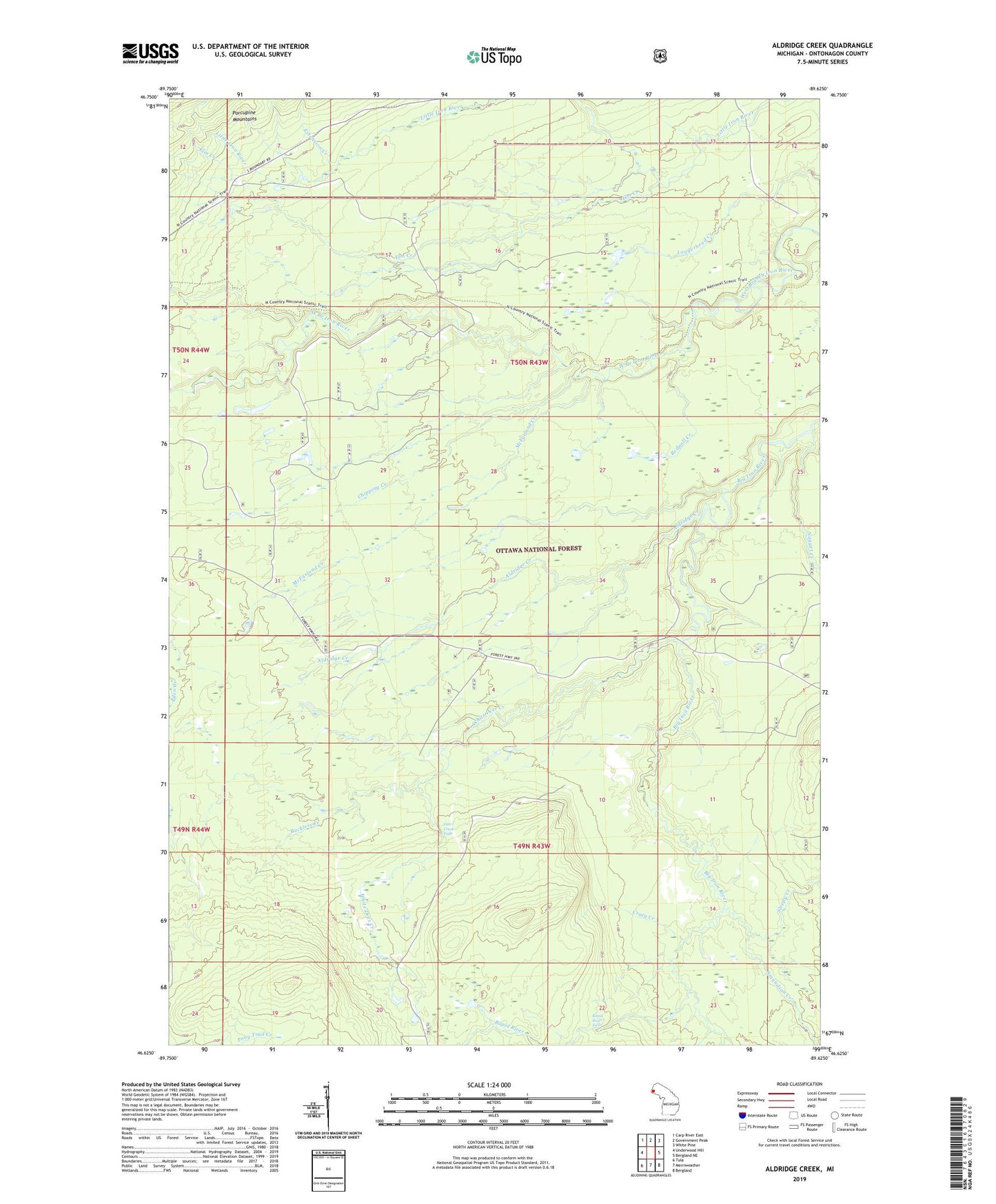
Aldridge Creek Michigan US Topo Map
Couldn't load pickup availability
Also explore the Aldridge Creek Forest Service Topo of this same quad for updated USFS data
2023 topographic map quadrangle Aldridge Creek in the state of Michigan. Scale: 1:24000. Based on the newly updated USGS 7.5' US Topo map series, this map is in the following counties: Ontonagon. The map contains contour data, water features, and other items you are used to seeing on USGS maps, but also has updated roads and other features. This is the next generation of topographic maps. Printed on high-quality waterproof paper with UV fade-resistant inks.
Quads adjacent to this one:
West: Underwood Hill
Northwest: Carp River East
North: Government Peak
Northeast: White Pine
East: Bergland NE
Southeast: Bergland
South: Merriweather
Southwest: Tula
This map covers the same area as the classic USGS quad with code o46089f6.
Contains the following named places: Aldridge Creek, Amundsan Creek, Buckless Creek, Chipping Creek, Crazy Creek, Deer Creek Falls, Elm Creek, Extension Creek, McFarland Creek, Nugget Creek, Rapid River, Rapid River Falls, Redpoll Creek, Shiras Creek, Sleepy Creek, Township of Carp Lake, White Deer Creek, White Pine Camp and Picnic Area, White Pine Extension Mine, ZIP Code: 49971