MyTopo
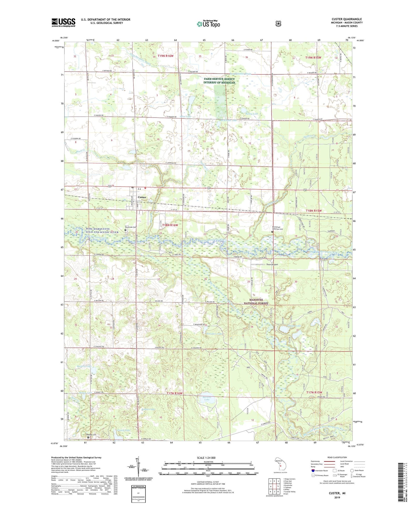
Custer Michigan US Topo Map
Couldn't load pickup availability
Also explore the Custer Forest Service Topo of this same quad for updated USFS data
2023 topographic map quadrangle Custer in the state of Michigan. Scale: 1:24000. Based on the newly updated USGS 7.5' US Topo map series, this map is in the following counties: Mason. The map contains contour data, water features, and other items you are used to seeing on USGS maps, but also has updated roads and other features. This is the next generation of topographic maps. Printed on high-quality waterproof paper with UV fade-resistant inks.
Quads adjacent to this one:
West: Scottville
Northwest: Kings Corners
North: Free Soil
Northeast: Millerton
East: Tallman
Southeast: Carr
South: Crystal Valley
Southwest: Wiley
This map covers the same area as the classic USGS quad with code o43086h2.
Contains the following named places: Allen Lake, Bailey Lake, Bartons Lake, Big South Branch Pere Marquette River, Black Creek, Clancy Lake, Comstock School, Custer, Custer Fire Department, Custer Lookout Tower, Custer Post Office, Custer Station, Dockery Lake, Emanuel Church, Emmanuel Lutheran Cemetery, Hatting Creek, Indian Trail, Lakeside Cemetery, Little River Band of Ottawa Indians Reservation, Mason County Eastern Junior - Senior High School, McClellan School, McKimzie Lake, Minega School, Mobey Lake, Notipekago Historical Marker, Rathburn Lake, Ressigue School, Riverside Cemetery, Riverside School, Saint Mary's Church, Saunders Lake, Sugar Ridge Church, Thorn Airport, Township of Custer, Village of Custer, Weldon Creek, Weldon Creek Post Office, Weldon Creek Station, Whelan Lake, ZIP Code: 49405