MyTopo
Carsonville Michigan US Topo Map
Couldn't load pickup availability
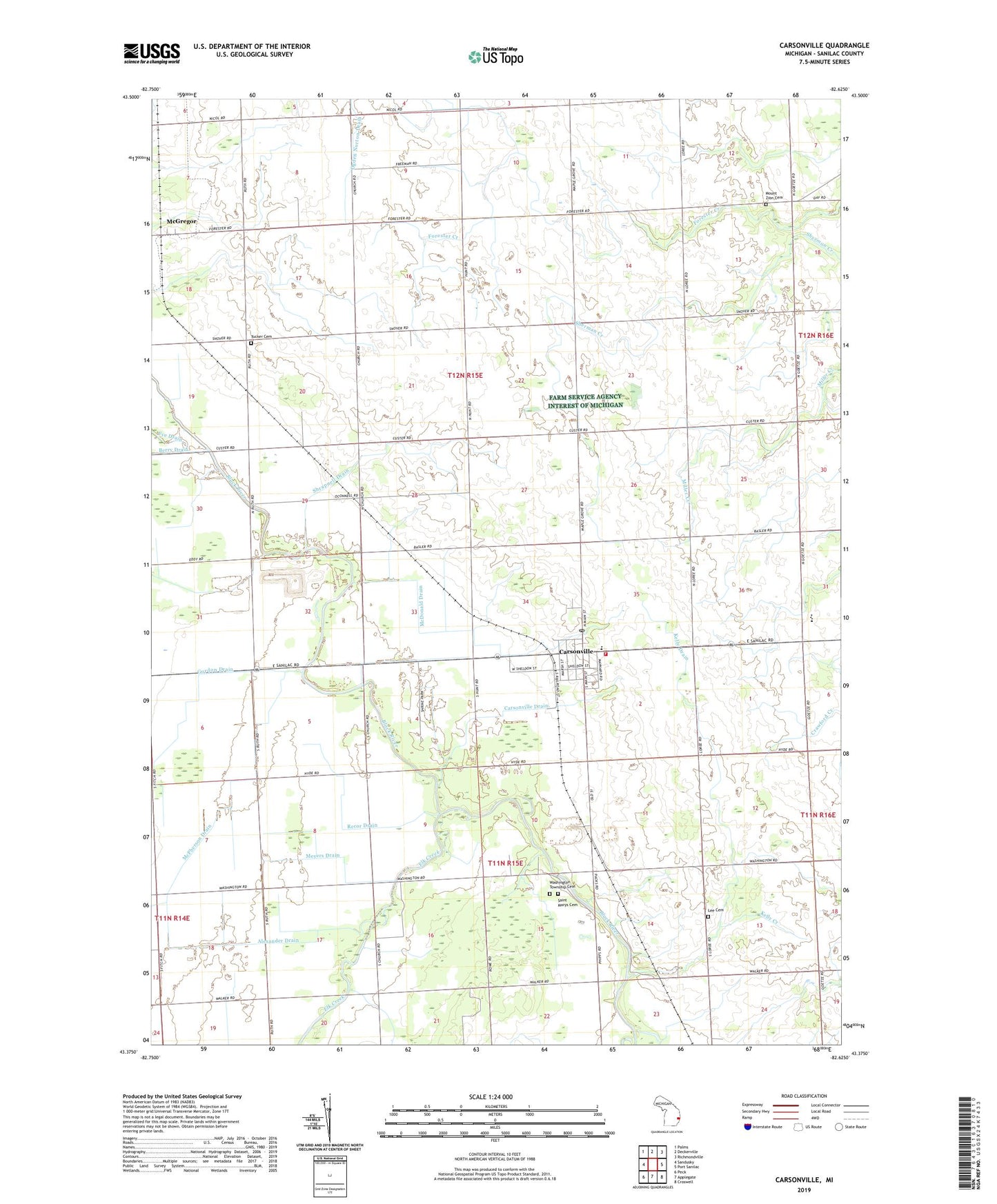
2023 topographic map quadrangle Carsonville in the state of Michigan. Scale: 1:24000. Based on the newly updated USGS 7.5' US Topo map series, this map is in the following counties: Sanilac. The map contains contour data, water features, and other items you are used to seeing on USGS maps, but also has updated roads and other features. This is the next generation of topographic maps. Printed on high-quality waterproof paper with UV fade-resistant inks.
Quads adjacent to this one:
West: Sandusky
Northwest: Palms
North: Deckerville
Northeast: Richmondville
East: Port Sanilac
Southeast: Croswell
South: Applegate
Southwest: Peck
This map covers the same area as the classic USGS quad with code o43082d6.
Contains the following named places: Alexander Drain, Baker School, Black River School, Bridge Hampton Township Hall, Bridgehampton Drain, Bridgehampton Post Office, Butler School, Carsonville, Carsonville Assembly of God Church, Carsonville Drain, Carsonville Fire Department, Carsonville Police Department, Carsonville Post Office, Carsonville Station, Carsonville-Port Sanilac Elementary School, Carsonville-Port Sanilac High School, Elk Creek, Gordon Drain, Hi-Way Drive-In Theater, Kelly Creek, Kelly Drain, Lee Cemetery, McDonald Drain, McGregor, McGregor Post Office, McGregor Station, McPherson Drain, Meyers Drain, Mount Zion Cemetery, Ogden Norton Drain, Pack's Mills Post Office, Pack's Mills Station, Recor Drain, Saint Marys Cemetery, Sanilac County, Shrapnell Drain, Township of Bridgehampton, Township of Washington, Tucker Cemetery, United Methodist Church, Village of Carsonville, Washington Township Cemetery, ZIP Code: 48419