MyTopo
Cedar River Michigan US Topo Map
Couldn't load pickup availability
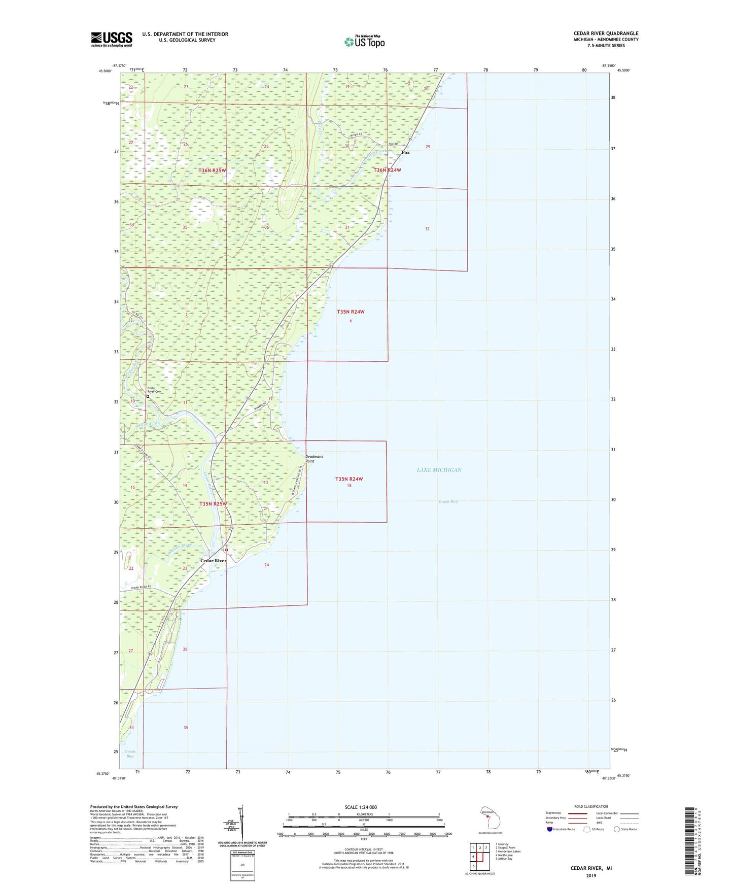
2023 topographic map quadrangle Cedar River in the state of Michigan. Scale: 1:24000. Based on the newly updated USGS 7.5' US Topo map series, this map is in the following counties: Menominee. The map contains contour data, water features, and other items you are used to seeing on USGS maps, but also has updated roads and other features. This is the next generation of topographic maps. Printed on high-quality waterproof paper with UV fade-resistant inks.
Quads adjacent to this one:
West: North Lake
Northwest: Gourley
North: Seagull Point
Northeast: Henderson Lakes
Southwest: Arthur Bay
This map covers the same area as the classic USGS quad with code o45087d3.
Contains the following named places: Cedar River, Cedar River Cemetery, Cedar River Community Chapel, Cedar River Post Office, Cedarville Township Volunteer Fire Department, Deadmans Point, Deer Creek, Elwood Creek, Fox, Fox Park, Fox Post Office, J W Wells State Park, Walton River