MyTopo
North Lake Michigan US Topo Map
Couldn't load pickup availability
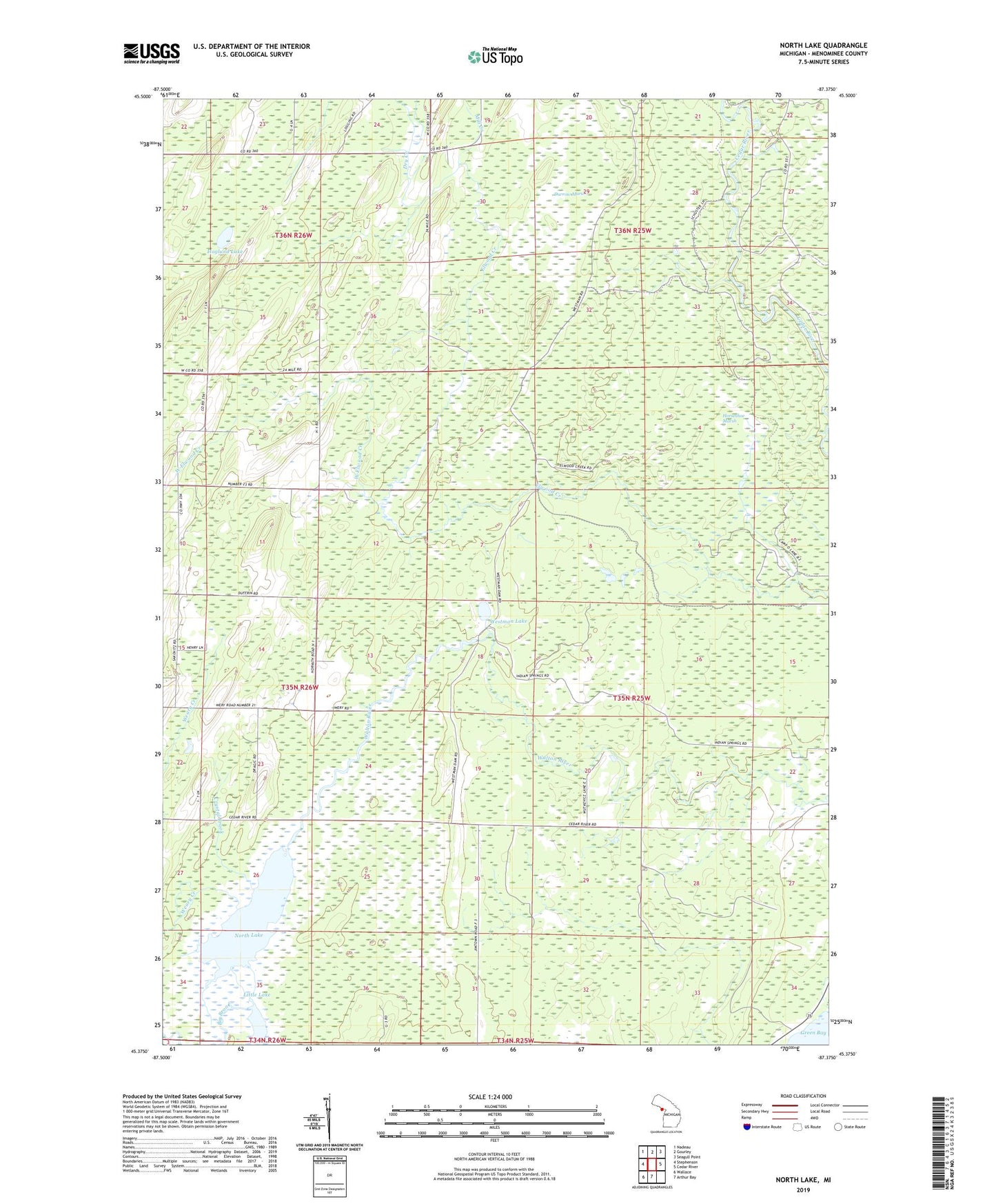
2023 topographic map quadrangle North Lake in the state of Michigan. Scale: 1:24000. Based on the newly updated USGS 7.5' US Topo map series, this map is in the following counties: Menominee. The map contains contour data, water features, and other items you are used to seeing on USGS maps, but also has updated roads and other features. This is the next generation of topographic maps. Printed on high-quality waterproof paper with UV fade-resistant inks.
Quads adjacent to this one:
West: Stephenson
Northwest: Nadeau
North: Gourley
Northeast: Seagull Point
East: Cedar River
South: Arthur Bay
Southwest: Wallace
This map covers the same area as the classic USGS quad with code o45087d4.
Contains the following named places: Big Brook, Cedar River North State Forest Campground, Crystal Brook, Dry Creek, Durrow Marsh, Green Bay, Hannahville Indian Community, Hoglund Lake, Horseshoe Marsh, Kessler Lake, Little Lake, Mill Creek, North Lake, Township of Cedarville, Weary Creek, West Elwood Creek, Westman Lake