MyTopo
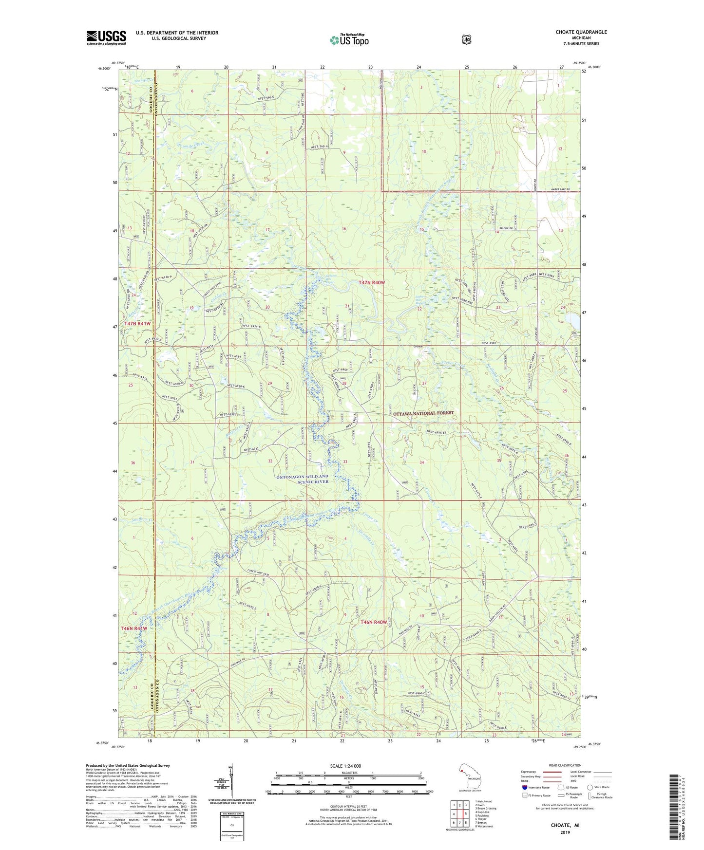
Choate Michigan US Topo Map
Couldn't load pickup availability
Also explore the Choate Forest Service Topo of this same quad for updated USFS data
2023 topographic map quadrangle Choate in the state of Michigan. Scale: 1:24000. Based on the newly updated USGS 7.5' US Topo map series, this map is in the following counties: Ontonagon, Gogebic. The map contains contour data, water features, and other items you are used to seeing on USGS maps, but also has updated roads and other features. This is the next generation of topographic maps. Printed on high-quality waterproof paper with UV fade-resistant inks.
Quads adjacent to this one:
West: Cup Lake
Northwest: Matchwood
North: Ewen
Northeast: Bruce Crossing
East: Paulding
Southeast: Watersmeet
South: Beaton
Southwest: Thayer
This map covers the same area as the classic USGS quad with code o46089d3.
Contains the following named places: Bluff Creek, Caddis Creek, Choate, Choate Creek, Choate Post Office, Choate Station, Cisco Branch Ontonagon River, Custer Creek, Eighteen Mile Rapids, Polau Creek, Ratford Creek, Redlight Creek, Snuffbox Creek, Steusser Lake, Sucker Creek, Tenmile Creek, Twomile Creek, Wolverine Falls