MyTopo
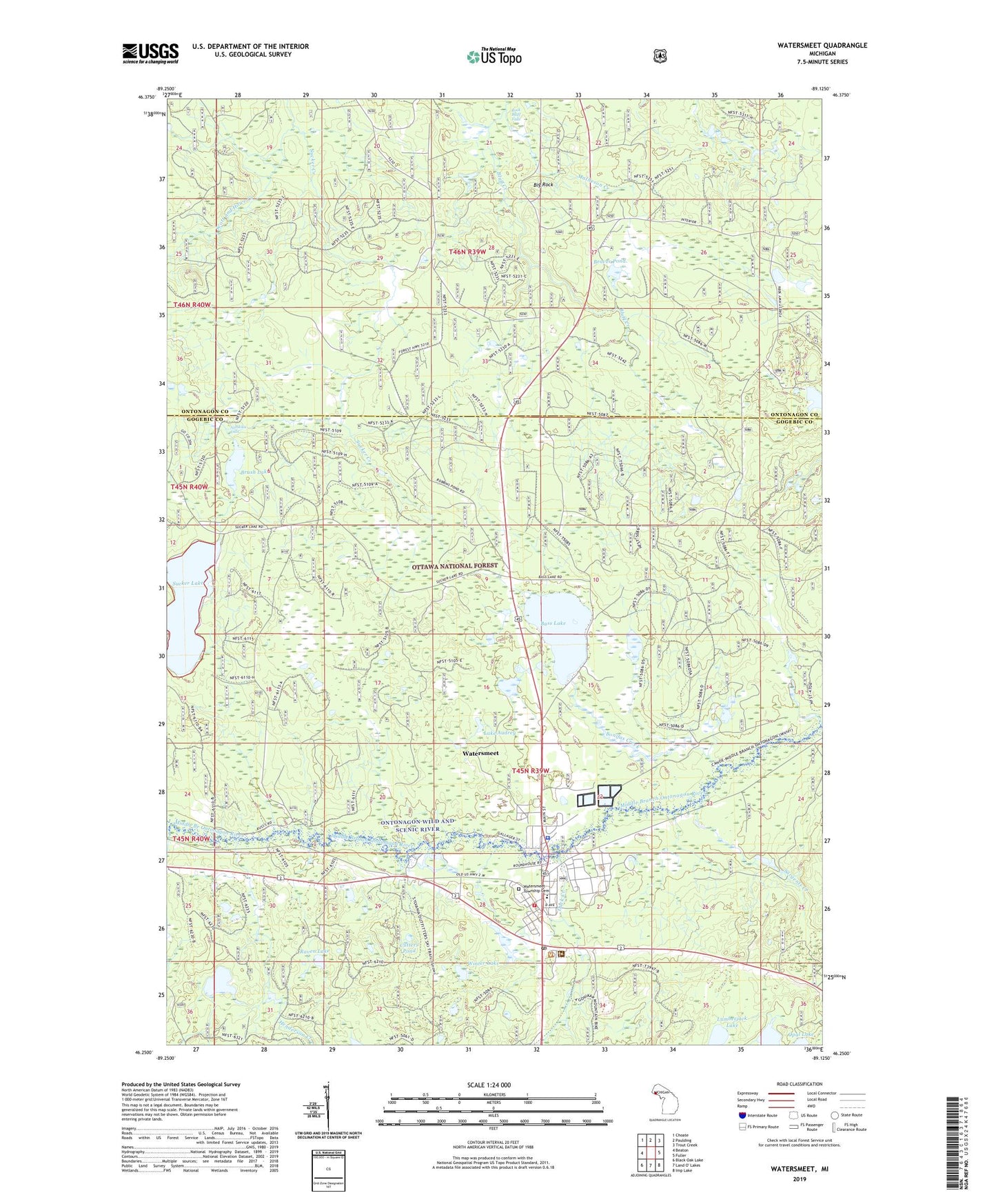
Watersmeet Michigan US Topo Map
Couldn't load pickup availability
Also explore the Watersmeet Forest Service Topo of this same quad for updated USFS data
2023 topographic map quadrangle Watersmeet in the state of Michigan. Scale: 1:24000. Based on the newly updated USGS 7.5' US Topo map series, this map is in the following counties: Gogebic, Ontonagon. The map contains contour data, water features, and other items you are used to seeing on USGS maps, but also has updated roads and other features. This is the next generation of topographic maps. Printed on high-quality waterproof paper with UV fade-resistant inks.
Quads adjacent to this one:
West: Beaton
Northwest: Choate
North: Paulding
Northeast: Trout Creek
East: Fuller
Southeast: Imp Lake
South: Land O' Lakes
Southwest: Black Oak Lake
This map covers the same area as the classic USGS quad with code o46089c2.
Contains the following named places: Ajibikika Falls, Bass Lake, Beaver Pond, Big Rock, Bonifas, Bonifas Creek, Bonifas Post Office, Brush Lake, Carlson Post Office, Cutters Pond, Deer Lake, Duck Creek, Henderson Creek, Lac Vieux Desert Clinic, Lac Vieux Desert Golf Course, Lac Vieux Desert Reservation, Lac Vieux Desert Tribal Police Department, Lake Audrey, Lumberjack Lake, Matheson Creek, Porcupine Lake, Raven Lake, Rock Bluff Falls, Sargents Creek, Scott and Howe Creek, Sylvania, T W Toumey Nursery, United States Forest Service Watersmeet Ranger District, Watersmeet, Watersmeet Baptist Church, Watersmeet Census Designated Place, Watersmeet Fish/Trout Hatchery, Watersmeet Medical Clinic, Watersmeet Post Office, Watersmeet Station, Watersmeet Township Cemetery, Watersmeet Township School, Watersmeet Township Volunteer Fire Department, Winter Lake, Zigzag Creek, ZIP Code: 49969