MyTopo
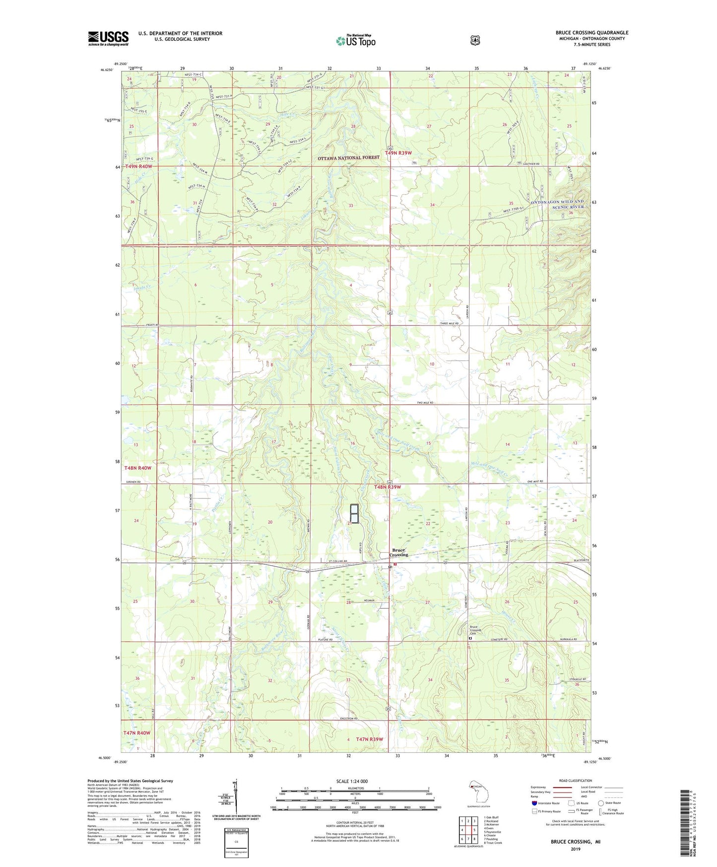
Bruce Crossing Michigan US Topo Map
Couldn't load pickup availability
Also explore the Bruce Crossing Forest Service Topo of this same quad for updated USFS data
2023 topographic map quadrangle Bruce Crossing in the state of Michigan. Scale: 1:24000. Based on the newly updated USGS 7.5' US Topo map series, this map is in the following counties: Ontonagon. The map contains contour data, water features, and other items you are used to seeing on USGS maps, but also has updated roads and other features. This is the next generation of topographic maps. Printed on high-quality waterproof paper with UV fade-resistant inks.
Quads adjacent to this one:
West: Ewen
Northwest: Oak Bluff
North: Rockland
Northeast: McKeever
East: Paynesville
Southeast: Trout Creek
South: Paulding
Southwest: Choate
This map covers the same area as the classic USGS quad with code o46089e2.
Contains the following named places: Balitmore, Bethany Lutheran Church, Bruce Crossing, Bruce Crossing Cemetery, Bruce Crossing Census Designated Place, Bruce Crossing Post Office, Bruce Crossing Volunteer Fire Department, Clear Creek, Gem, Hide Creek, House Creek, Inkala Creek, Mile and One-half Creek, North Bruce Church, Perttus Big Spruce Golf Course, Pietila Creek, Pine Creek, Saint Cullins Creek, Sonco Ambulance, Stannard Township Park, Township of Stannard, Western Upper Peninsula Health Center