MyTopo
Swimming Hole Creek Michigan US Topo Map
Couldn't load pickup availability
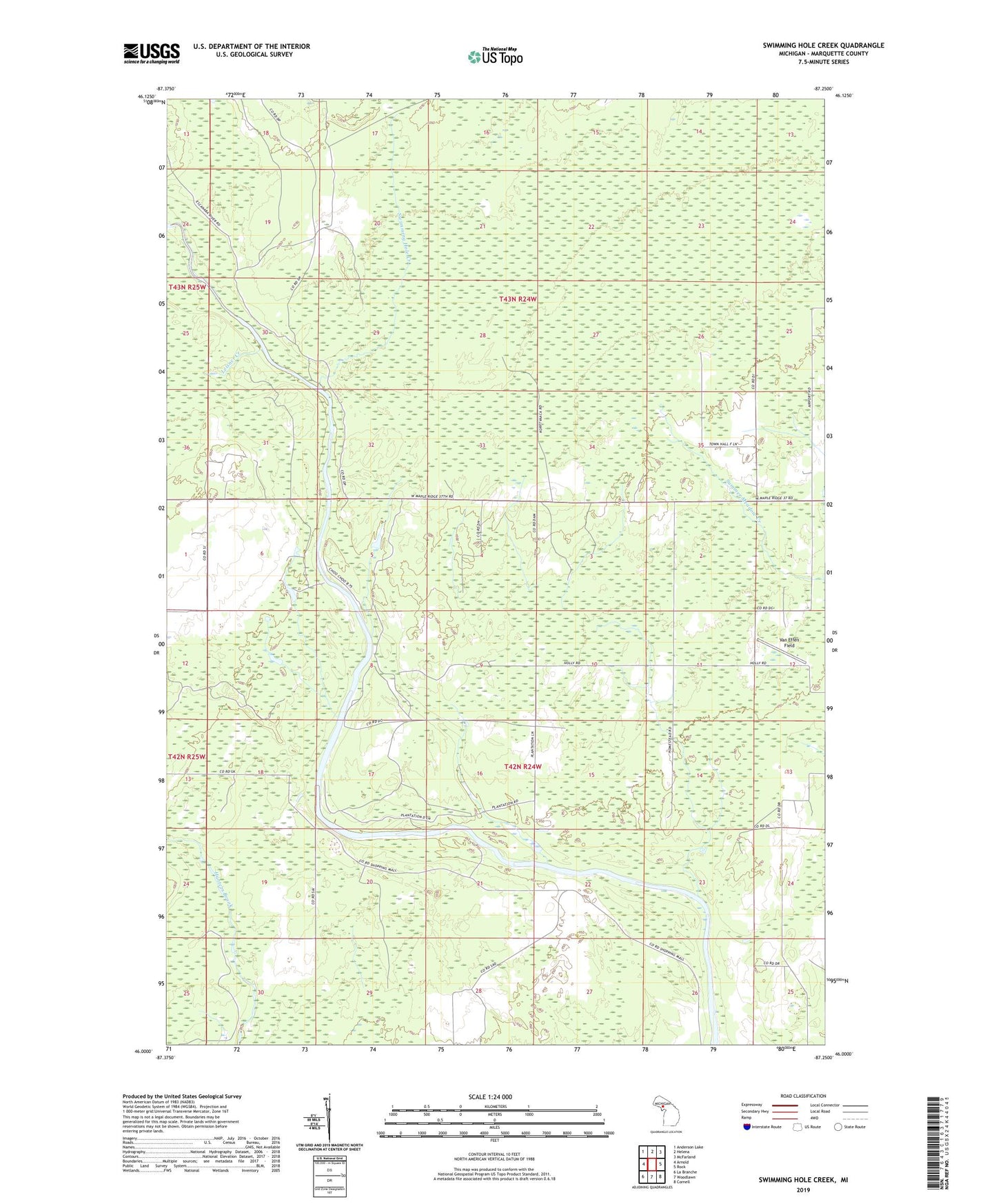
2023 topographic map quadrangle Swimming Hole Creek in the state of Michigan. Scale: 1:24000. Based on the newly updated USGS 7.5' US Topo map series, this map is in the following counties: Marquette. The map contains contour data, water features, and other items you are used to seeing on USGS maps, but also has updated roads and other features. This is the next generation of topographic maps. Printed on high-quality waterproof paper with UV fade-resistant inks.
Quads adjacent to this one:
West: Arnold
Northwest: Anderson Lake
North: Helena
Northeast: McFarland
East: Rock
Southeast: Cornell
South: Woodlawn
Southwest: La Branche
This map covers the same area as the classic USGS quad with code o46087a3.
Contains the following named places: Boney Falls Basin, Bonnie Field Airport, Leisner Creek, Swimming Hole Creek, Township of Ewing, Van Effen Field