MyTopo
Crump Michigan US Topo Map
Couldn't load pickup availability
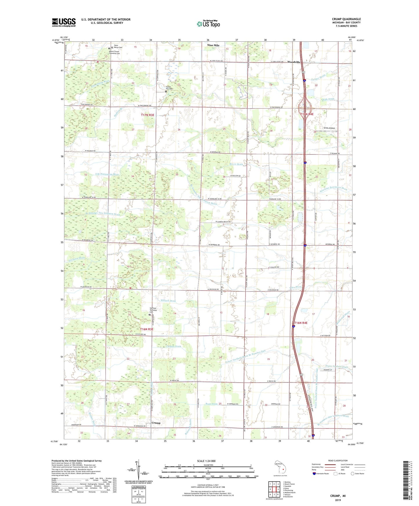
2023 topographic map quadrangle Crump in the state of Michigan. Scale: 1:24000. Based on the newly updated USGS 7.5' US Topo map series, this map is in the following counties: Bay. The map contains contour data, water features, and other items you are used to seeing on USGS maps, but also has updated roads and other features. This is the next generation of topographic maps. Printed on high-quality waterproof paper with UV fade-resistant inks.
Quads adjacent to this one:
West: Estey
Northwest: Bentley
North: Mount Forest
Northeast: Standish
East: Pinconning
Southeast: Kawkawlin
South: Willard
Southwest: Midland North
This map covers the same area as the classic USGS quad with code o43084g1.
Contains the following named places: Bryce Drain, Coggins Drain, Crump, Crump Church, Crump Post Office, Erickson Drain, Forest Hill Cemetery, Fraser Church, Fraser Garfield Drain Branch Number One, Fraser Garfield Drain Branch Number Two, Garfield Church, Garfield Post Office, Garfield Township Cemetery, Garfield Township Fire Department Station 21, Garfield-Fraser School, Gross Airport, Hudson Branch, Lee Davis Drain, Linwood Rest Area, Mount Forest Oil Field, Mount Forest School, Mount Forest Township Cemetery, Mount Forest Township Fire Department Station 23, Ryan Drain, Saint Marys Cemetery, Saint Marys Church, Selman Drain, South Branch Pinconning River, Township of Garfield, Township of Mount Forest, Uhlman Drain, Willard Drain, WKQZ-FM (Midland), WMJT-FM (Pinconning), Woodville