MyTopo
Willard Michigan US Topo Map
Couldn't load pickup availability
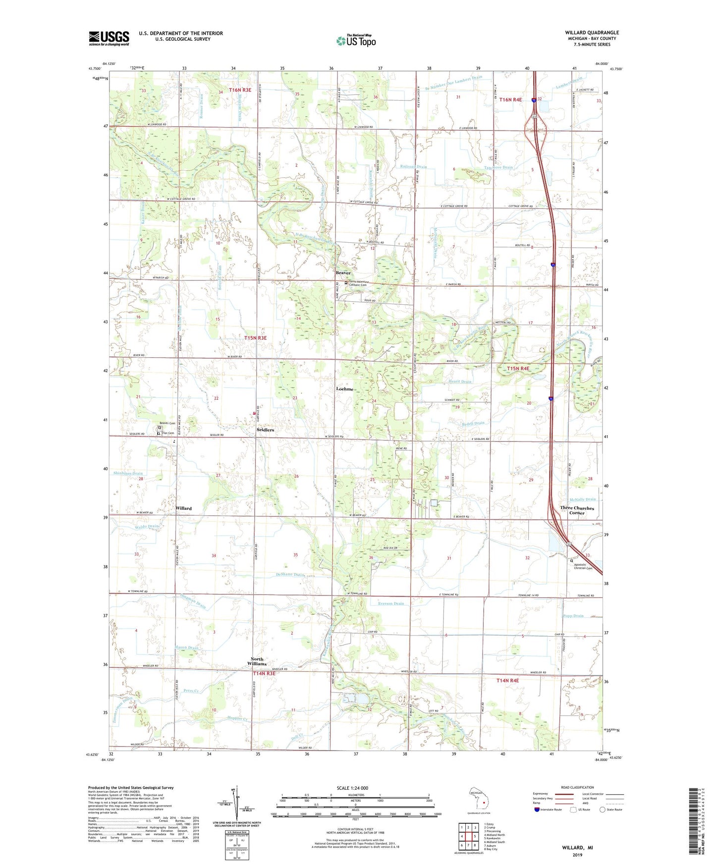
2023 topographic map quadrangle Willard in the state of Michigan. Scale: 1:24000. Based on the newly updated USGS 7.5' US Topo map series, this map is in the following counties: Bay. The map contains contour data, water features, and other items you are used to seeing on USGS maps, but also has updated roads and other features. This is the next generation of topographic maps. Printed on high-quality waterproof paper with UV fade-resistant inks.
Quads adjacent to this one:
West: Midland North
Northwest: Estey
North: Crump
Northeast: Pinconning
East: Kawkawlin
Southeast: Bay City
South: Auburn
Southwest: Midland South
This map covers the same area as the classic USGS quad with code o43084f1.
Contains the following named places: Anderson Drain, Apostolic Christian Cemetery, Apostolic Christian Church, Auburn Care Center, Bay City Gospel Hall, Beaver, Beaver Cemetery, Beaver Township Fire Department Station 19, Beaver Township Hall, Bedell Drain, Betzold Drain, Campbell Drain, Cassube Drain, Cherry School, Crump Drain, Dell Creek, DeShano Drain, Dietline Drain, Everson Drain, Fraser Road Church of God, Gilbert School, Hearit Drain, Hildebrandt Drain, Hoppler Creek, James Drain, Kaiser Drain, Kawalski Drain, Lapan Drain, Loehme, Loehne Post Office, Mason Drain, McDonald Drain, McNally Drain, Monison Drain, North Williams, North Williams Post Office, Ott School, Oxbow School, Perry Creek, Reinhardt Drain, Renner Drain, Saint Bartholomew Lutheran Church, Saint Bartholomew Lutheran School, Saint Valentine Catholic Cemetery, Saint Valentines Church, Saint Valentines School, Seidlers, Tap-Gove Drain, Three Churches Corner, Township of Beaver, Vogtman Drain, Waldo Drain, Warren School, White Birch Hills Golf Course, White Birch Village Mobile Home Park, Willams Post Office, Willard, Willard Post Office, Zion Cemetery, Zion Lutheran Church, Zion School, ZIP Codes: 48611, 48634