MyTopo
Estey Michigan US Topo Map
Couldn't load pickup availability
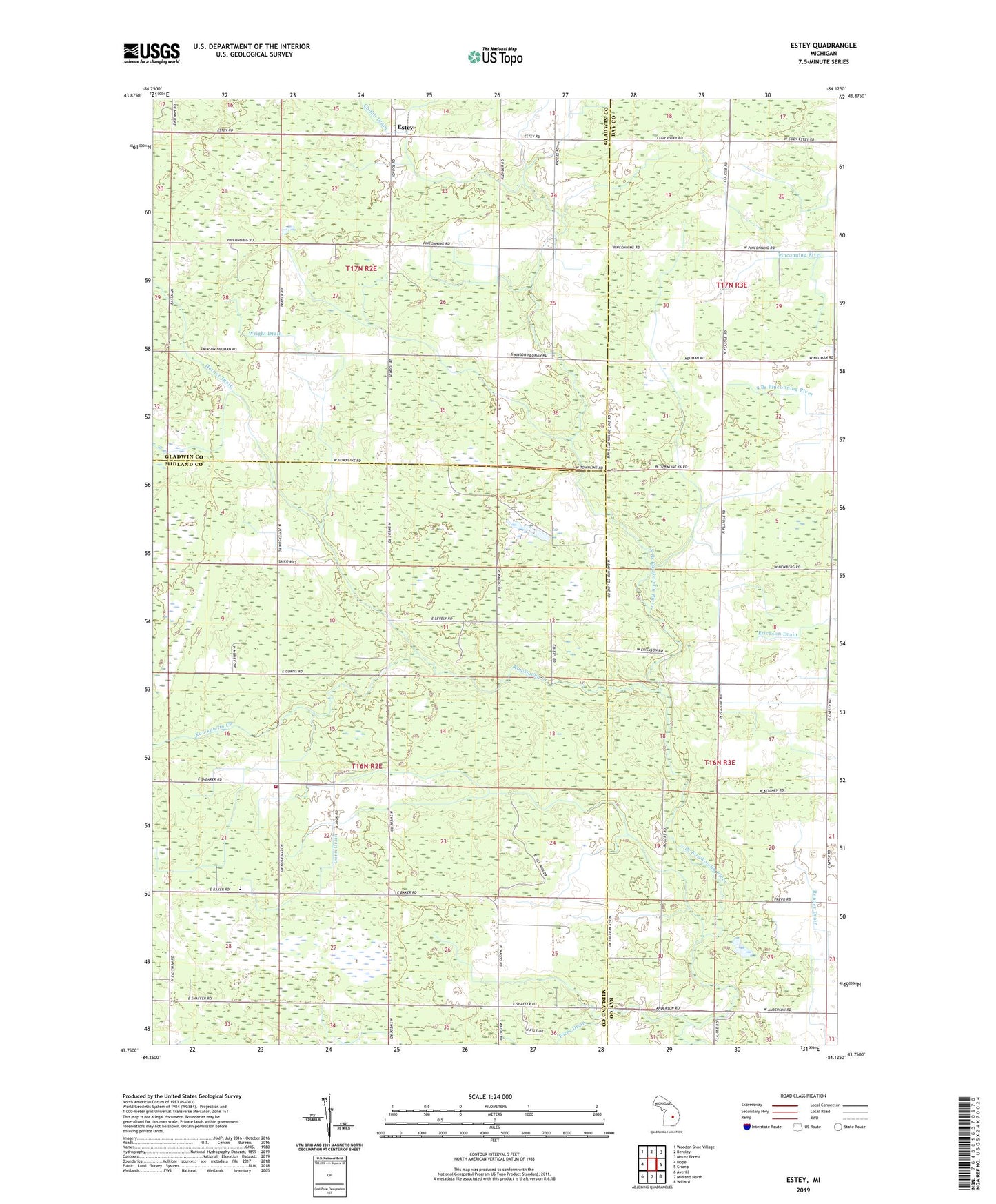
2023 topographic map quadrangle Estey in the state of Michigan. Scale: 1:24000. Based on the newly updated USGS 7.5' US Topo map series, this map is in the following counties: Midland, Bay, Gladwin. The map contains contour data, water features, and other items you are used to seeing on USGS maps, but also has updated roads and other features. This is the next generation of topographic maps. Printed on high-quality waterproof paper with UV fade-resistant inks.
Quads adjacent to this one:
West: Hope
Northwest: Wooden Shoe Village
North: Bentley
Northeast: Mount Forest
East: Crump
Southeast: Willard
South: Midland North
Southwest: Averill
This map covers the same area as the classic USGS quad with code o43084g2.
Contains the following named places: Bentley Oil Field, Bethel Church, Bethel Church of the Nazarene, Brier Post Office, Estey, Estey Post Office, Glencoe Post Office, Gunn Drain, Herner Drain, Hoffman Drain, Kawkawlin Creek, Mills School, Mills Township Fire Department, Torey Drain, Township of Bentley, Township of Mills, Watson Drain, Wilson Drain, Wright Drain, ZIP Code: 48652