MyTopo
Deckerville Michigan US Topo Map
Couldn't load pickup availability
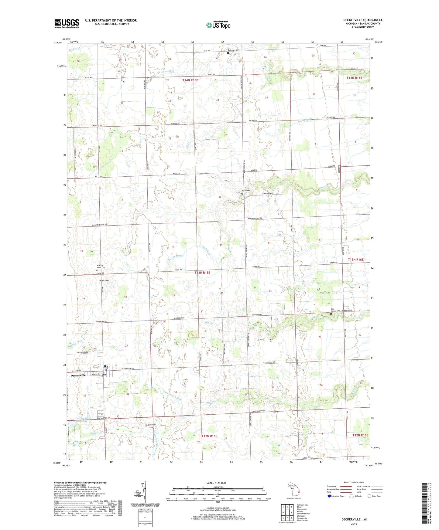
2019 topographic map quadrangle Deckerville in the state of Michigan. Scale: 1:24000. Based on the newly updated USGS 7.5' US Topo map series, this map is in the following counties: Sanilac. The map contains contour data, water features, and other items you are used to seeing on USGS maps, but also has updated roads and other features. This is the next generation of topographic maps. Printed on high-quality waterproof paper with UV fade-resistant inks.
Quads adjacent to this one:
West: Palms
Northwest: Minden City
North: Ruth
Northeast: Forestville
East: Richmondville
Southeast: Port Sanilac
South: Carsonville
Southwest: Sandusky
Contains the following named places: Bridgehampton Church, Cedardale Church, Deckerville, Deckerville Church, Deckerville Community High School, Deckerville Community Hospital, Deckerville Fire Department, Deckerville Police Department, Deckerville Post Office, Deckerville Public Library, Deckerville Reservoir, Delaware Cemetery, Dowington Post Office, East Marion Cemetery, East Marion Church, Evans Drain, Farnsworth Drain, First Baptist Church, First United Presbyterian Church, Gospel Hall Church, Grandy Drain, Hunt School, Indian Creek Ranch Airport, Leitch Post Office, Mills Cemetery, Mills Post Office, Osgood Drain, Parson Drain, Rosbury Cemetery, Rusnell Farm Cemetery, Saint Johns Church, Snay Post Office, Township of Marion, Village of Deckerville, Wright Cemetery, ZIP Codes: 48427, 48465