MyTopo
Devils Corner Michigan US Topo Map
Couldn't load pickup availability
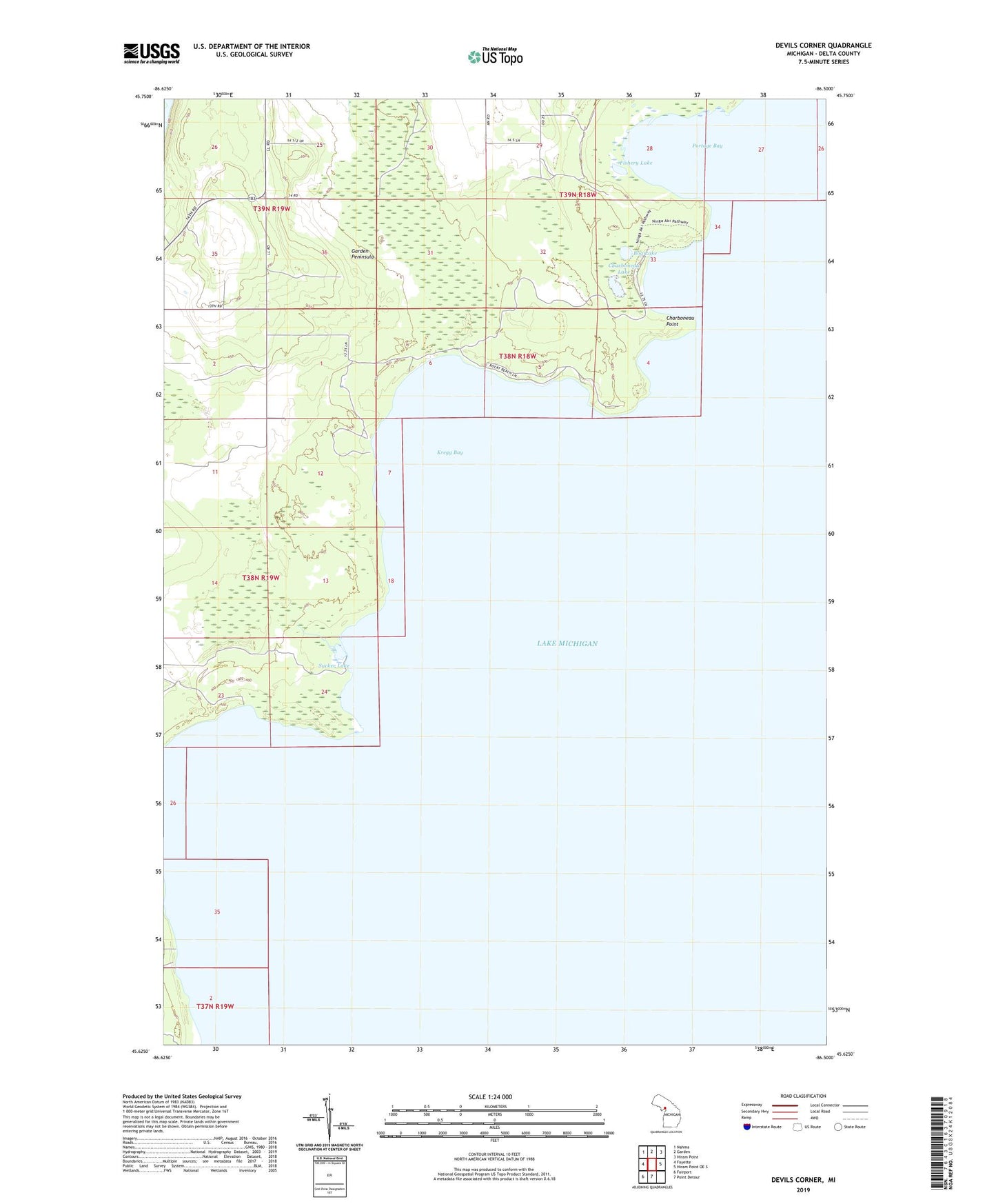
2023 topographic map quadrangle Devils Corner in the state of Michigan. Scale: 1:24000. Based on the newly updated USGS 7.5' US Topo map series, this map is in the following counties: Delta. The map contains contour data, water features, and other items you are used to seeing on USGS maps, but also has updated roads and other features. This is the next generation of topographic maps. Printed on high-quality waterproof paper with UV fade-resistant inks.
Quads adjacent to this one:
West: Fayette
Northwest: Nahma
North: Garden
Northeast: Hiram Point
East: Hiram Point OE S
South: Point Detour
Southwest: Fairport
This map covers the same area as the classic USGS quad with code o45086f5.
Contains the following named places: Bog Lake, Charboneau Lake, Charboneau Point, Devils Corner, Fishery Lake, Gillnet Haven, Kregg Bay, Portage Bay, Portage Bay State Campground, Sucker Lake, ZIP Code: 49835