MyTopo
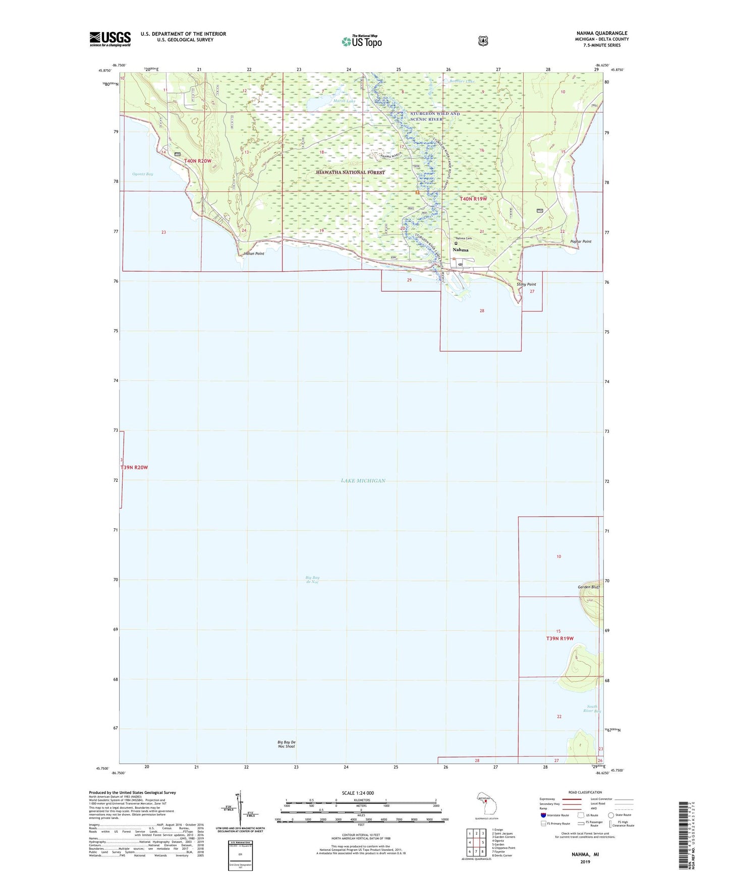
Nahma Michigan US Topo Map
Couldn't load pickup availability
Also explore the Nahma Forest Service Topo of this same quad for updated USFS data
2023 topographic map quadrangle Nahma in the state of Michigan. Scale: 1:24000. Based on the newly updated USGS 7.5' US Topo map series, this map is in the following counties: Delta. The map contains contour data, water features, and other items you are used to seeing on USGS maps, but also has updated roads and other features. This is the next generation of topographic maps. Printed on high-quality waterproof paper with UV fade-resistant inks.
Quads adjacent to this one:
West: Ogontz
Northwest: Ensign
North: Saint Jacques
Northeast: Garden Corners
East: Garden
Southeast: Devils Corner
South: Fayette
Southwest: Chippewa Point
This map covers the same area as the classic USGS quad with code o45086g6.
Contains the following named places: Big Bay de Noc, Big Bay De Noc Shoal, Boutlier Lake, Bull Run, Garden Bluff, Indian Point, Indian Point Cemetery, Lacomb Bay, Marsh Lake, Nahma, Nahma Cemetery, Nahma Post Office, Poplar Point, Saint Lawrence Church, South River Bay, Stony Point, Sturgeon River, ZIP Code: 49864