MyTopo
Donken Michigan US Topo Map
Couldn't load pickup availability
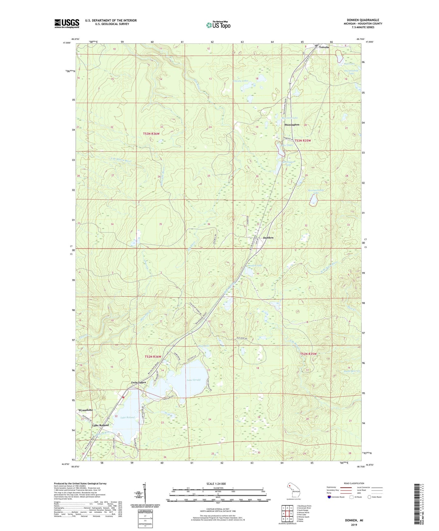
2019 topographic map quadrangle Donken in the state of Michigan. Scale: 1:24000. Based on the newly updated USGS 7.5' US Topo map series, this map is in the following counties: Houghton. The map contains contour data, water features, and other items you are used to seeing on USGS maps, but also has updated roads and other features. This is the next generation of topographic maps. Printed on high-quality waterproof paper with UV fade-resistant inks.
Quads adjacent to this one:
West: Winona North
Northwest: Rockhouse Point
North: Graveraet River
Northeast: South Range
East: Pine Lake
Southeast: Pelkie
South: Nisula
Southwest: Winona South
Contains the following named places: Donken, Donken Lake, Donken Post Office, Donken Station, Elm River Lookout Tower, Elm River Station, Elmriver Post Office, Hall Lake, Lake Gerald, Lake Ongie, Lake Roland, Lake Roland Station, Michigan Department of Natural Resources Twin Lakes Field Office, Morrison Lake, Mud Lake, Seventeenmile Lake, Shawmut Mine, Stenington Station, Stonington, Stonington Lake, Toivola, Toivola Lakes, Toivola Post Office, Toivola Station, Township of Elm River, Twin Lakes, Twin Lakes - Elm River Fire Department, Twin Lakes Park, Wyandotte Hills Golf Course, ZIP Code: 49965