MyTopo
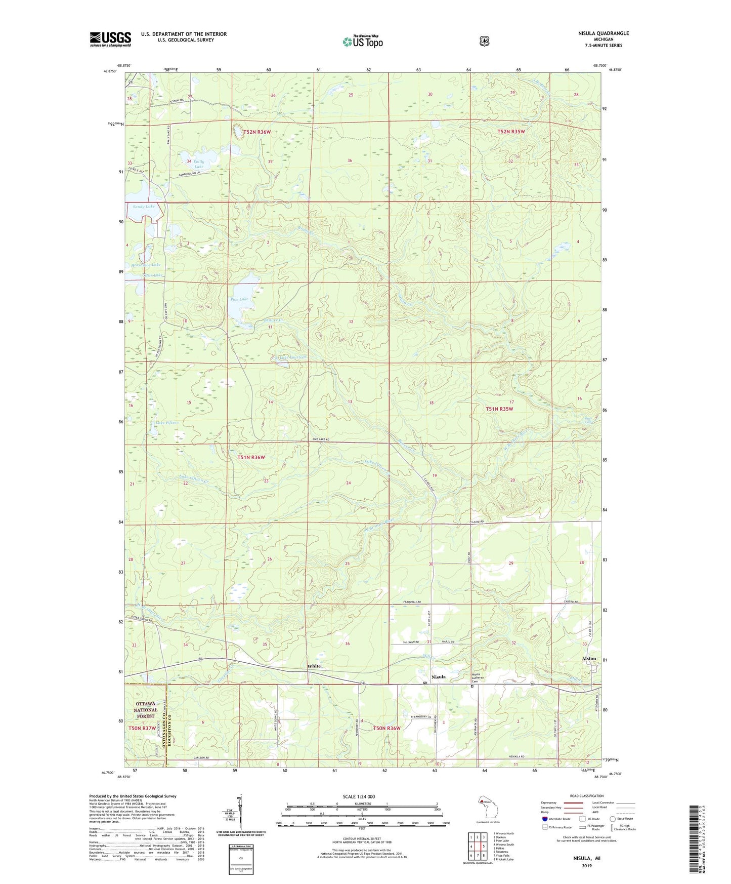
Nisula Michigan US Topo Map
Couldn't load pickup availability
Also explore the Nisula Forest Service Topo of this same quad for updated USFS data
2023 topographic map quadrangle Nisula in the state of Michigan. Scale: 1:24000. Based on the newly updated USGS 7.5' US Topo map series, this map is in the following counties: Houghton, Ontonagon. The map contains contour data, water features, and other items you are used to seeing on USGS maps, but also has updated roads and other features. This is the next generation of topographic maps. Printed on high-quality waterproof paper with UV fade-resistant inks.
Quads adjacent to this one:
West: Winona South
Northwest: Winona North
North: Donken
Northeast: Pine Lake
East: Pelkie
Southeast: Prickett Lake
South: Vista Falls
Southwest: Rousseau
This map covers the same area as the classic USGS quad with code o46088g7.
Contains the following named places: Alston, Alston Post Office, Baraga State Forest, Beaver Creek, Bruno Creek, Clear Lake, Emily Lake, Kratt Lakes, Lake Fifteen, Lake Fifteen Creek, Lake Fourteen, Nisula, Nisula Lutheran Cemetery, Nisula Post Office, Otter Falls, Pike Lake, Saint Henrys Church, Sandy Lake, White