MyTopo
Winona South Michigan US Topo Map
Couldn't load pickup availability
Also explore the Winona South Forest Service Topo of this same quad for updated USFS data
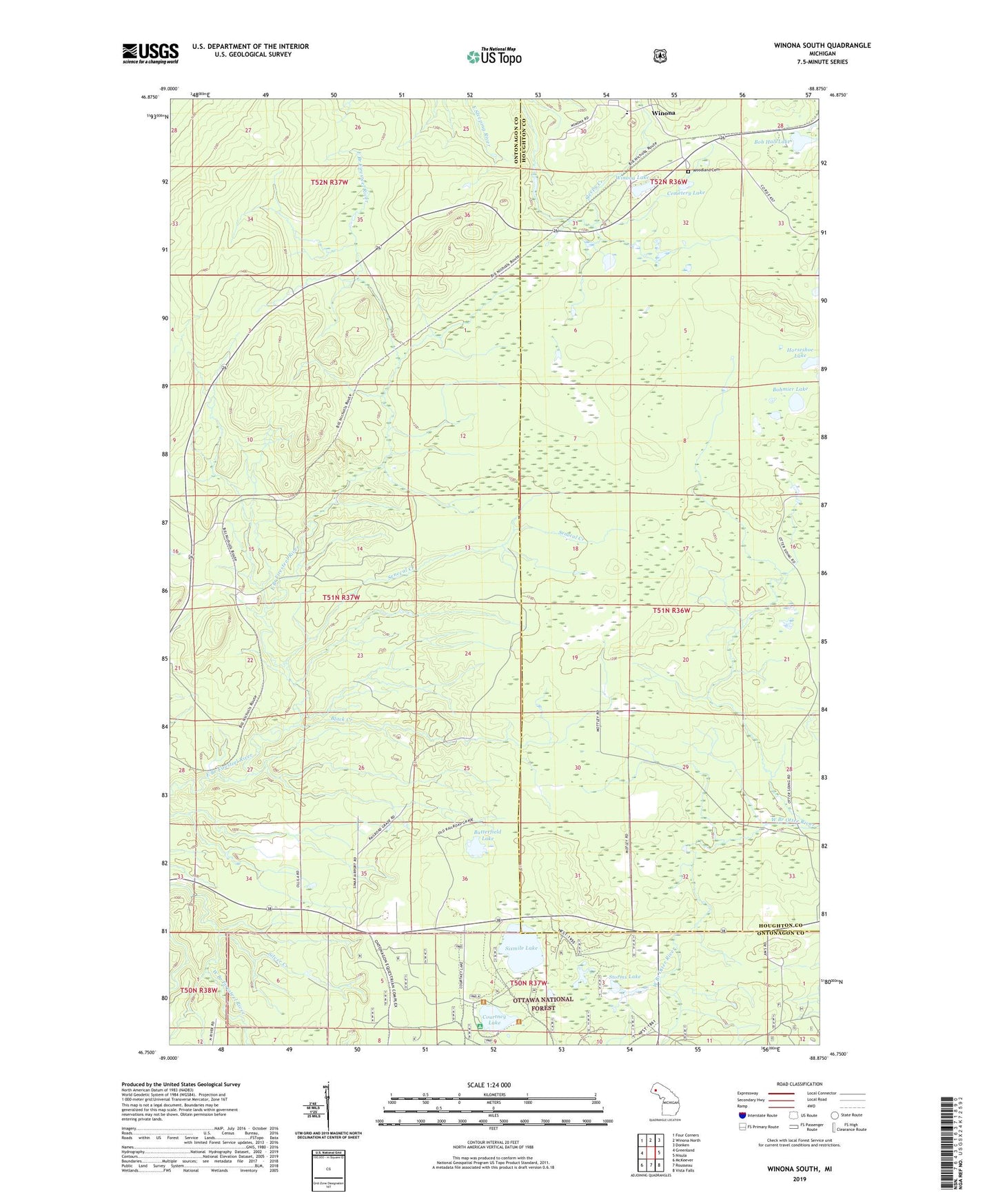
2023 topographic map quadrangle Winona South in the state of Michigan. Scale: 1:24000. Based on the newly updated USGS 7.5' US Topo map series, this map is in the following counties: Ontonagon, Houghton. The map contains contour data, water features, and other items you are used to seeing on USGS maps, but also has updated roads and other features. This is the next generation of topographic maps. Printed on high-quality waterproof paper with UV fade-resistant inks.
Quads adjacent to this one:
West: Greenland
Northwest: Four Corners
North: Winona North
Northeast: Donken
East: Nisula
Southeast: Vista Falls
South: Rousseau
Southwest: McKeever
This map covers the same area as the classic USGS quad with code o46088g8.
Contains the following named places: Black Creek, Bob Hall Lake, Bohmier Lake, Butterfield Lake, Cemetery Lake, Courtney Lake, Courtney Lake Camp and Picnic Area, Horseshoe Lake, Indiana Mine, Mottley, Otter, Senecal Creek, Silver Creek, Simar Landing Strip, Sixmile Lake, Sleepy Dam, Storms Lake, Township of Bohemia, Winona, Winona Lake, Winona Mine, Winona Post Office, Winona Station, Woodland Cemetery