MyTopo
Dowling Michigan US Topo Map
Couldn't load pickup availability
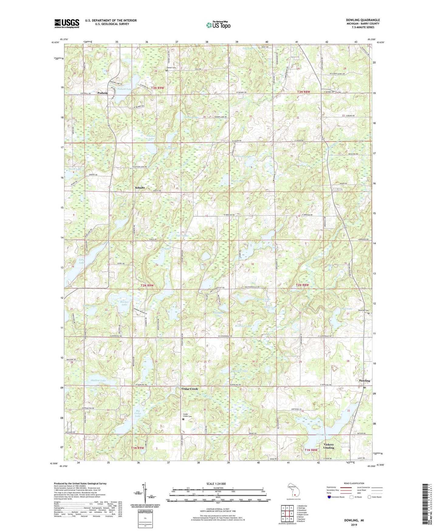
2023 topographic map quadrangle Dowling in the state of Michigan. Scale: 1:24000. Based on the newly updated USGS 7.5' US Topo map series, this map is in the following counties: Barry. The map contains contour data, water features, and other items you are used to seeing on USGS maps, but also has updated roads and other features. This is the next generation of topographic maps. Printed on high-quality waterproof paper with UV fade-resistant inks.
Quads adjacent to this one:
West: Cloverdale
Northwest: Middleville
North: Hastings
Northeast: Woodland
East: Maple Grove
Southeast: Bedford
South: Banfield
Southwest: Delton
This map covers the same area as the classic USGS quad with code o42085e3.
Contains the following named places: Aurohn Lake, Baltimore Church, Barry County, Bawker Lake, Big Cedar Lake, Brewster Lake, Bristol Corners, Cedar Creek, Cedar Creek Bible Church, Cedar Creek Cemetery, Cedarcreek Post Office, Clear Lake, Country Chapel, Cox Lake, Doud School, Dowling, Dowling Cemetery, Dowling Census Designated Place, Dowling Post Office, Dowling Public Library, Dowling School, Faith Temple, Gesler Lake, Gregory School, Hendershott School, Hinds School, Hope Township District Number Four School Historical Marker, Hope United Methodist Church, Horseshoe Lake, Howard Lake, Kellie Creek, Larabee Lake, Lily Lake, Little Cedar Lake, Little Pine Lake, McOmber School, Mud Lake, Myers Lake, Newton Lake, North Branch Cedar Creek, Perch Lake, Pierce Lake, Podunk, Podunk Lake, Pritchardville Post Office, Schultz, Shallow Lake, Shultz Post Office, Shultz School, Shultz Station, Star School, Tanner Cemetery, Tanner Lake, Tanner School, Tillotson Lake, Township of Hope, Twin Lakes, Vickery Landing, Weeks School, Wesleyan Conference Grounds, Whitefish Lake, Zigler Lake