MyTopo
Maple Grove Michigan US Topo Map
Couldn't load pickup availability
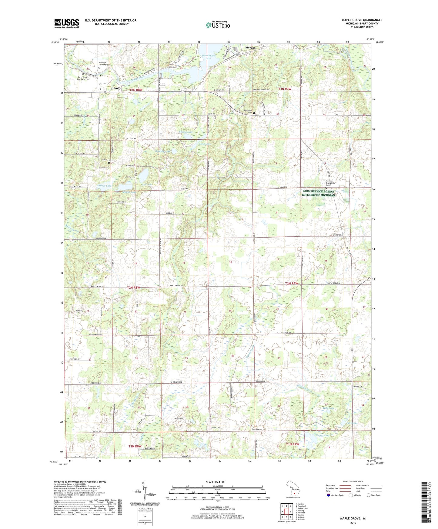
2023 topographic map quadrangle Maple Grove in the state of Michigan. Scale: 1:24000. Based on the newly updated USGS 7.5' US Topo map series, this map is in the following counties: Barry. The map contains contour data, water features, and other items you are used to seeing on USGS maps, but also has updated roads and other features. This is the next generation of topographic maps. Printed on high-quality waterproof paper with UV fade-resistant inks.
Quads adjacent to this one:
West: Dowling
Northwest: Hastings
North: Woodland
Northeast: Saubee Lake
East: Nashville
Southeast: Bellevue
South: Bedford
Southwest: Banfield
This map covers the same area as the classic USGS quad with code o42085e2.
Contains the following named places: Barry County Christian School, Barry County Extended Care Facility, Barry County Poor Farm Cemetery, Barry's Resort and Mobile Home Park, Barryville Cemetery, Barryville Historical Marker, Barryville Post Office, Barryville School, Branch School, Brethren Church, Camp Kitanniwa, Cedar Creek, Charlton Park, Dunhan School, Durfee School, Ellis Lake, Ellison Lake, German Evangelical Cemetery, Gregory Lake, Hall Lake, Hastings Township Cemetery, High Bank Creek, Highbank Post Office, Indian Landing-Charlton Park Historical Marker, Laurel Manor Rest Home, Long Lake, Maple Grove, Maple Grove Post Office, Maple Leaf Grange Hall, McKelvey School, Middle Lake, Mills School, Mixer Lake, Moore School, Morgan, Morgan Post Office, Morgan Station, Peace United Methodist Church, Pratt School, Quimby Post Office, Quimby Station, Quimby United Methodist Church, Qumby, Rivergate Family Campground, Squaw Brook, Striker Cemetery, Striker School, Taylor Lake, Thornapple Lake, Thornapple Lake Estates Mobile Home Park, Township of Baltimore, Township of Maple Grove, Union Cemetery, Wild Lake, ZIP Codes: 49050, 49073