MyTopo
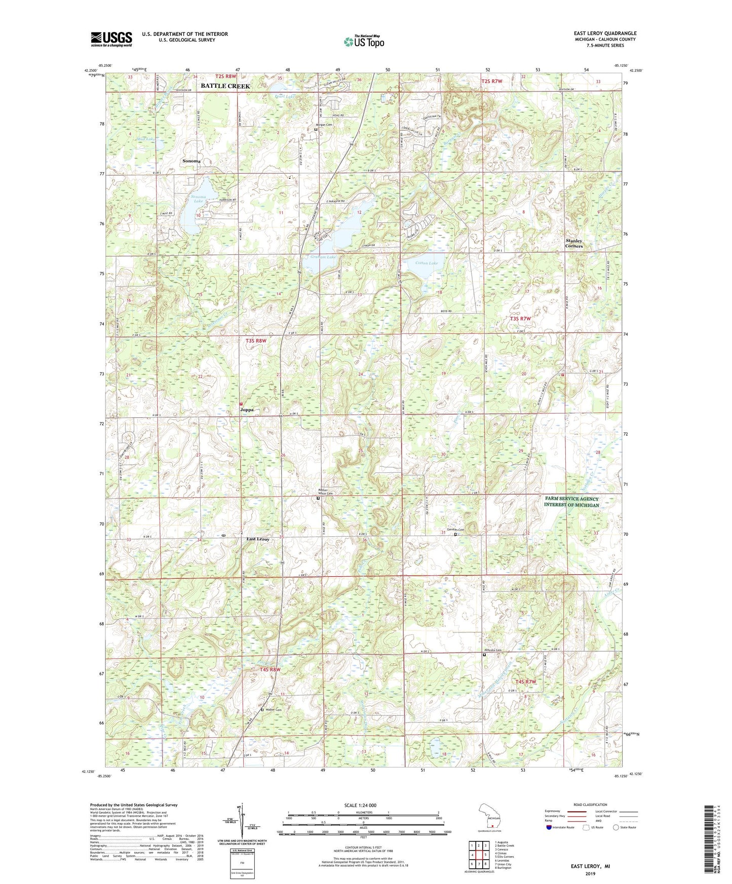
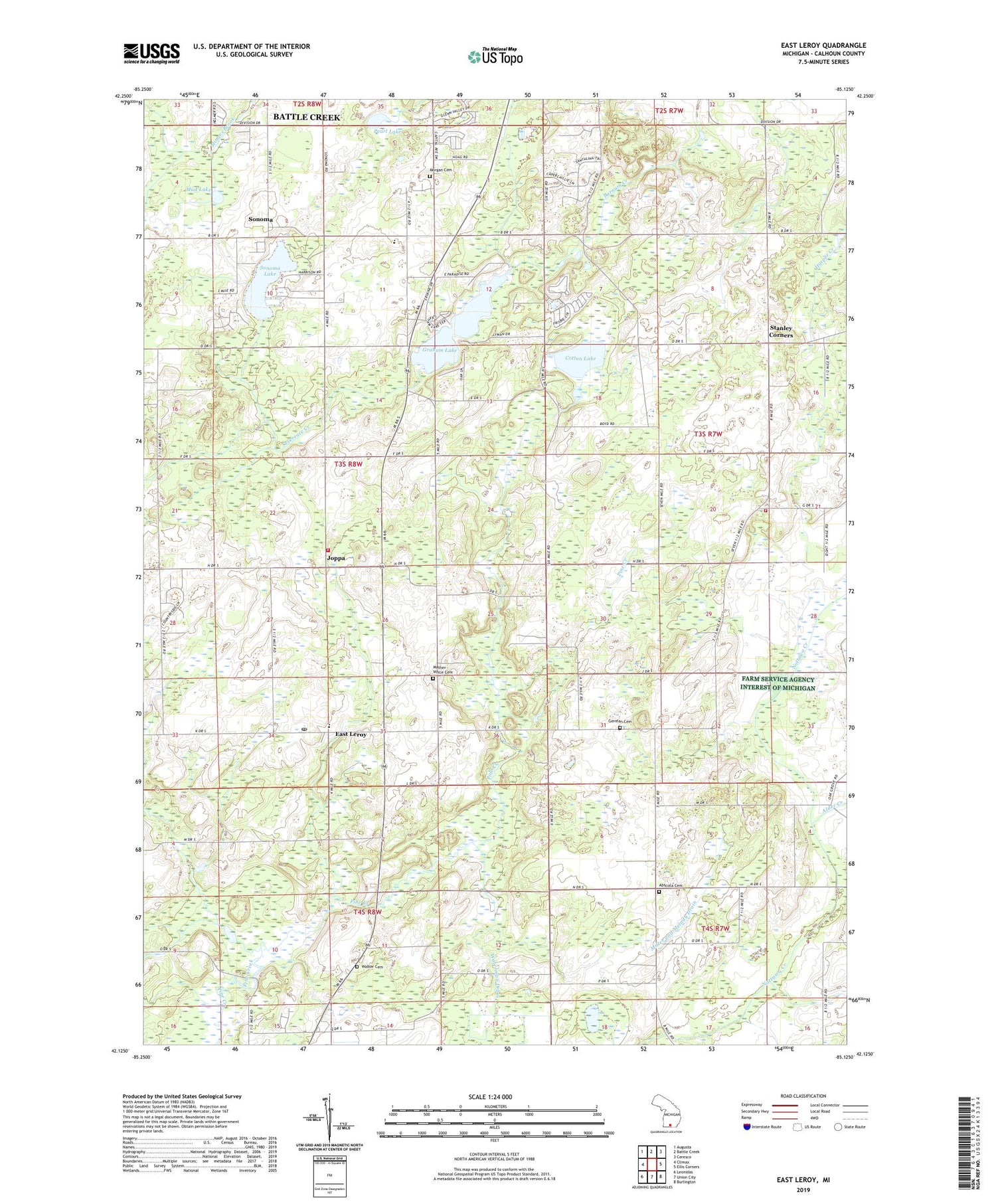
East Leroy Michigan US Topo Map
Couldn't load pickup availability
2019 topographic map quadrangle East Leroy in the state of Michigan. Scale: 1:24000. Based on the newly updated USGS 7.5' US Topo map series, this map is in the following counties: Calhoun. The map contains contour data, water features, and other items you are used to seeing on USGS maps, but also has updated roads and other features. This is the next generation of topographic maps. Printed on high-quality waterproof paper with UV fade-resistant inks.
Quads adjacent to this one:
West: Climax
Northwest: Augusta
North: Battle Creek
Northeast: Ceresco
East: Ellis Corners
Southeast: Burlington
South: Union City
Southwest: Leonidas
Contains the following named places: Abscota Cemetery, Abscota Post Office, Abscota School, Alder Creek, Binder Park Golf Course, Birchwood Estates Mobile Home Park, Blackett School, Burrell School, Camp Holston, Cedar Farms Golf Club, Charles Binder Park, Coates School, Cotton Lake, East Leroy, East Leroy Community Church, East Leroy Elementary School, East Leroy Post Office, East Leroy Station, French Drain, German Cemetery, Graham Lake, Hickory Hills Village Mobile Home Park, Houghton Drain, Joppa, Joppa Post Office, Joppa Station, Leroy Township Fire Department, Mather - Voyce Cemetery, Miller and Melody Drain, Morgan Cemetery, Morgan Corners, Mud Lake, Newton Post Office, Newton School, Newton Township Fire Department, Old Red School, Paradise School, Pearl Lake, Severence Creek, Sonoma, Sonoma Elementary School, Sonoma Lake, Sonoma Post Office, Sonoma Station, Stanley Corners, Stanley Post Office, Township of Leroy, Walker Cemetery, Walker School, Waterman Drain, ZIP Code: 49051