MyTopo
Ozark Michigan US Topo Map
Couldn't load pickup availability
Also explore the Ozark Forest Service Topo of this same quad for updated USFS data
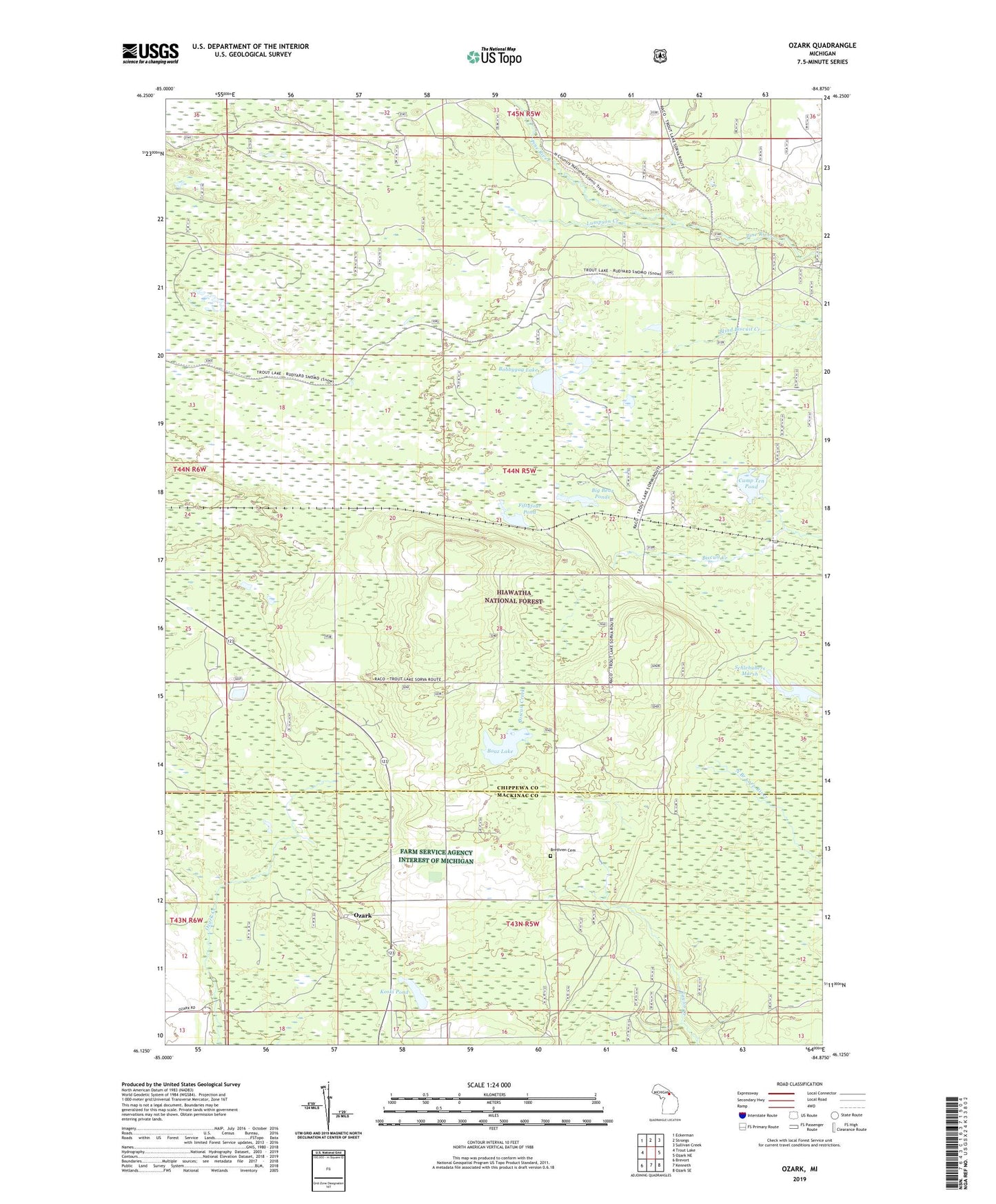
2023 topographic map quadrangle Ozark in the state of Michigan. Scale: 1:24000. Based on the newly updated USGS 7.5' US Topo map series, this map is in the following counties: Chippewa, Mackinac. The map contains contour data, water features, and other items you are used to seeing on USGS maps, but also has updated roads and other features. This is the next generation of topographic maps. Printed on high-quality waterproof paper with UV fade-resistant inks.
Quads adjacent to this one:
West: Trout Lake
Northwest: Eckerman
North: Strongs
Northeast: Sullivan Creek
East: Ozark NE
Southeast: Ozark SE
South: Kenneth
Southwest: Brevort
This map covers the same area as the classic USGS quad with code o46084b8.
Contains the following named places: Big Bear Ponds, Boaz Lake, Bobbygay Lake, Brethren Cemetery, Brethren Church, Camp Ten Pond, Dick Campground, Fiftyfour Pond, Koski Pond, Lumpson Creek, Old Dick, Ozark, Ozark Post Office, Ozark Station, Pine River Primitive Campground, Schlehubers Marsh, Township of Trout Lake, Trout Lake Lookout Tower