MyTopo
Edmore Michigan US Topo Map
Couldn't load pickup availability
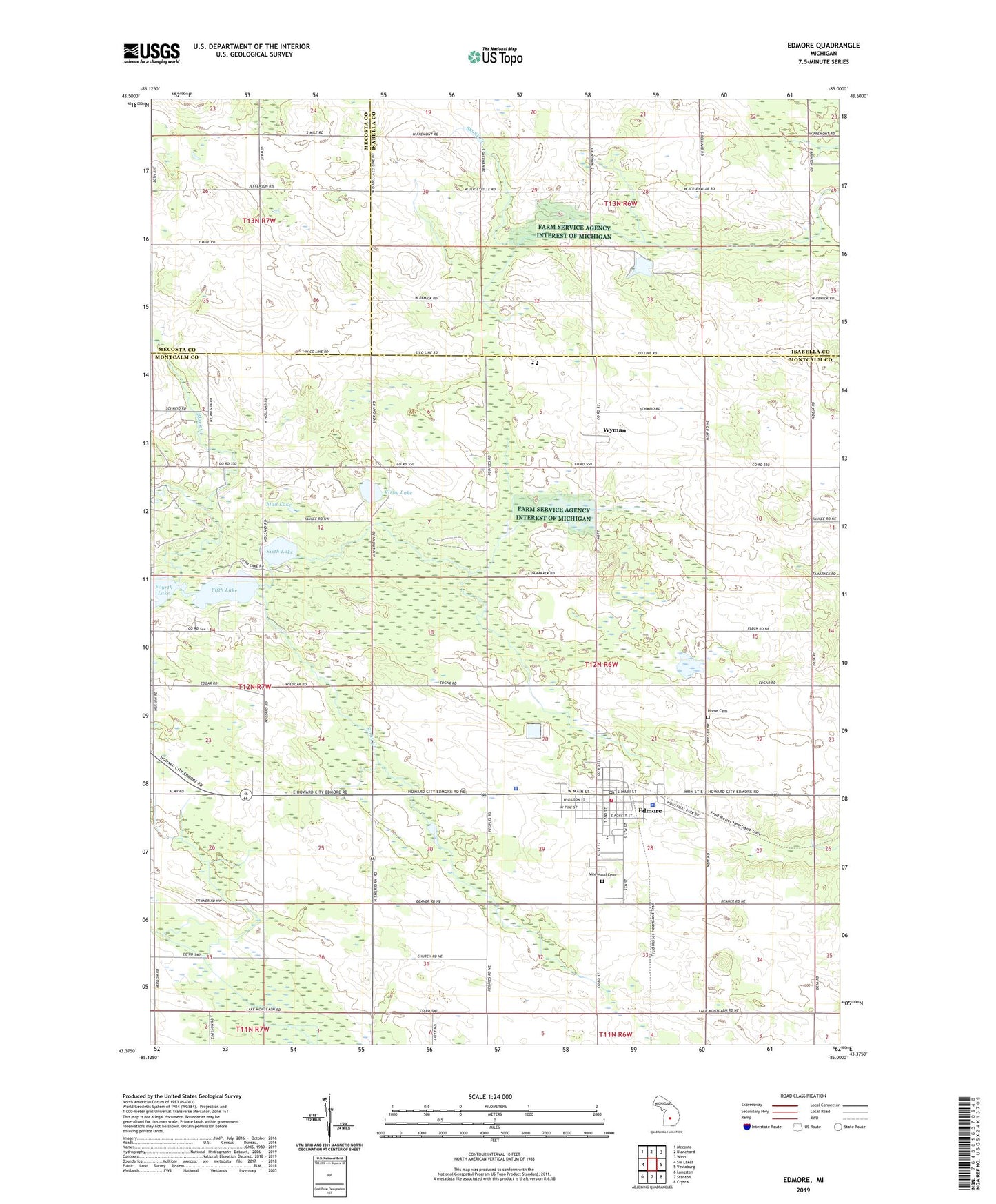
2019 topographic map quadrangle Edmore in the state of Michigan. Scale: 1:24000. Based on the newly updated USGS 7.5' US Topo map series, this map is in the following counties: Montcalm, Isabella, Mecosta. The map contains contour data, water features, and other items you are used to seeing on USGS maps, but also has updated roads and other features. This is the next generation of topographic maps. Printed on high-quality waterproof paper with UV fade-resistant inks.
Quads adjacent to this one:
West: Six Lakes
Northwest: Mecosta
North: Blanchard
Northeast: Winn
East: Vestaburg
Southeast: Crystal
South: Stanton
Southwest: Langston
Contains the following named places: Black Creek, Christenson Oil Field, Cutler Savage Church, Edmore, Edmore Care Clinic, Edmore Golf Course, Edmore Mobile Home Park, Edmore Post Office, Edmore Station, Faith United Methodist Church, Family Campground, Family Health Center, Farm Service Agency Interest of Michigan, Fifth Lake, First Baptist Church, First Church of God, Fourth Lake, Home Cemetery, Home Township Fire Department, Home Township Library, Home Township Police Department, Johnson Pond, Kirby Lake, Montabella High School, Montabella Middle School, Montcalm County Sheriff's Office Edmore Unit, Mud Lake, Nature's Chain of Lakes Campground, Old Fence Rider Museum, Our Saviour's Lutheran Church, Saint Margaret Mary's Church, Seventh Day Adventist Church, Six Lakes Gas Field, Sixth Lake, Stony Creek, Township of Home, Village of Edmore, Vinewood Cemetery, Webb Elementary School, Wyman, Wyman Post Office, Wyman Station, ZIP Code: 48829