MyTopo
Mecosta Michigan US Topo Map
Couldn't load pickup availability
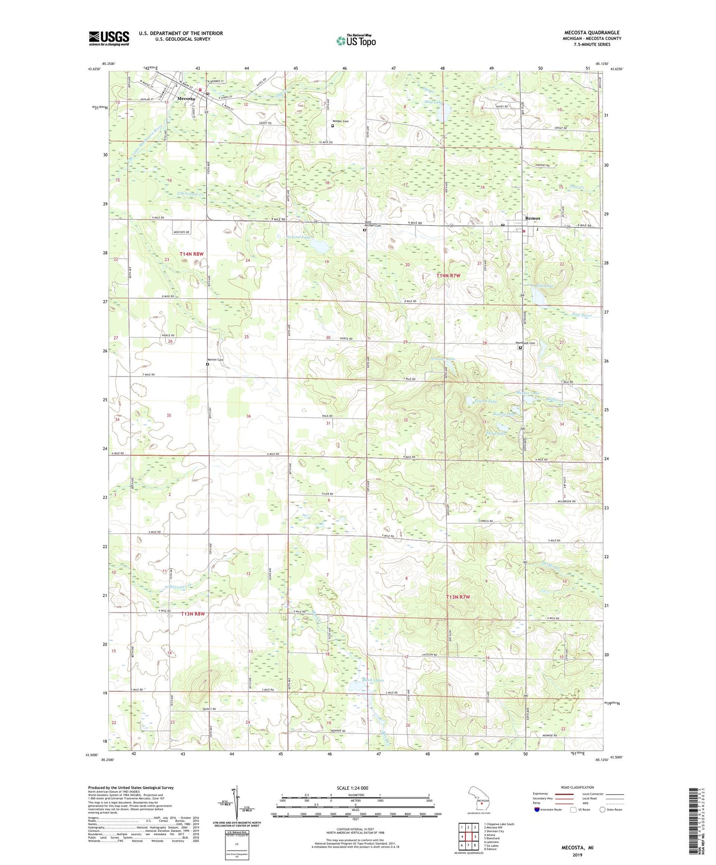
2023 topographic map quadrangle Mecosta in the state of Michigan. Scale: 1:24000. Based on the newly updated USGS 7.5' US Topo map series, this map is in the following counties: Mecosta. The map contains contour data, water features, and other items you are used to seeing on USGS maps, but also has updated roads and other features. This is the next generation of topographic maps. Printed on high-quality waterproof paper with UV fade-resistant inks.
Quads adjacent to this one:
West: Altona
Northwest: Chippewa Lake South
North: Mecosta NW
Northeast: Sherman City
East: Blanchard
Southeast: Edmore
South: Six Lakes
Southwest: Lakeview
This map covers the same area as the classic USGS quad with code o43085e2.
Contains the following named places: Black Lakes, Chippewa Hills Assembly of God Church, Chippewa Hills Baptist Church, Cross Church, East Schrader Creek, Fourth Lake, Halls Corner, Harris Lake, Mecosta, Mecosta Elementary School, Mecosta Post Office, Mecosta Station, Meeker Lake, Morgan Cemetery, Morton Cemetery, Morton Township Fire and Rescue Station Number 2, Morton Township Library, Mud Lake, New Hope United Methodist Church, Pickerel Lake, Pine Lake, Remus, Remus Elementary School, Remus Post Office, Remus Station, Saint Michael Cemetery, Saint Michael Church, Saint Michael School, Saint Paul's Lutheran Church, Schoner Lake, Third Lake, Township of Millbrook, Township of Wheatland, Village of Mecosta, Wamboldt Cemetery, Wesleyan Holiness Campground, Wheatland Church of Christ Historical Marker, Wheatland Township Fire Department, Wheatland Township Library, ZIP Code: 49332