MyTopo
Six Lakes Michigan US Topo Map
Couldn't load pickup availability
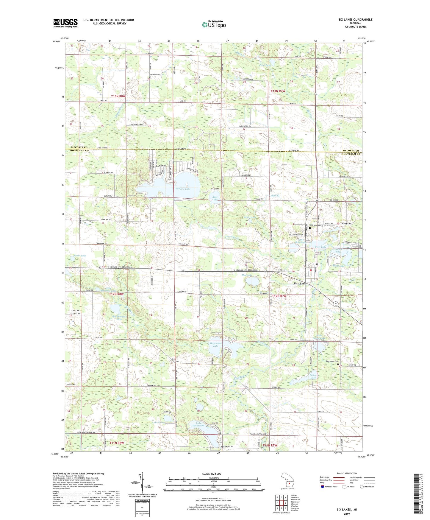
2023 topographic map quadrangle Six Lakes in the state of Michigan. Scale: 1:24000. Based on the newly updated USGS 7.5' US Topo map series, this map is in the following counties: Montcalm, Mecosta. The map contains contour data, water features, and other items you are used to seeing on USGS maps, but also has updated roads and other features. This is the next generation of topographic maps. Printed on high-quality waterproof paper with UV fade-resistant inks.
Quads adjacent to this one:
West: Lakeview
Northwest: Altona
North: Mecosta
Northeast: Blanchard
East: Edmore
Southeast: Stanton
South: Langston
Southwest: Trufant
This map covers the same area as the classic USGS quad with code o43085d2.
Contains the following named places: Basin Lake, Bass Beach Campground, Bass Lake, Belvidere Church, Belvidere Post Office, Belvidere Township Fire Department, Bible Missionary Church, Big Brimmer Lake, Brimmer Creek, Cato Cemetery, Church of the Gentle Shepherd, Clear Lake, Evergreen Cemetery, First Lake, First Lake Park, Fouts School, Hillcrest Cemetery, Horseshoe Creek, Horseshoe Lake, Lake Forest, Lake Montcalm, Lakeview Seventh Day Adventist Church, Little Bass Lake, Little Brimmer Lake, Little Penny Lake, Montabella Community School, Morton Cemetery, Mud Lake, Penny Lake, Pleasant View Church, Pleasant View United Brethren Church, Schmied Park, Second Lake, Six Lakes, Six Lakes Post Office, Six Lakes Station, Third Lake, Townline Creek, Townline Lake, Township of Belvidere, Wolf Creek, Wolf Lake, ZIP Codes: 48850, 48886