MyTopo
Ellis Corners Michigan US Topo Map
Couldn't load pickup availability
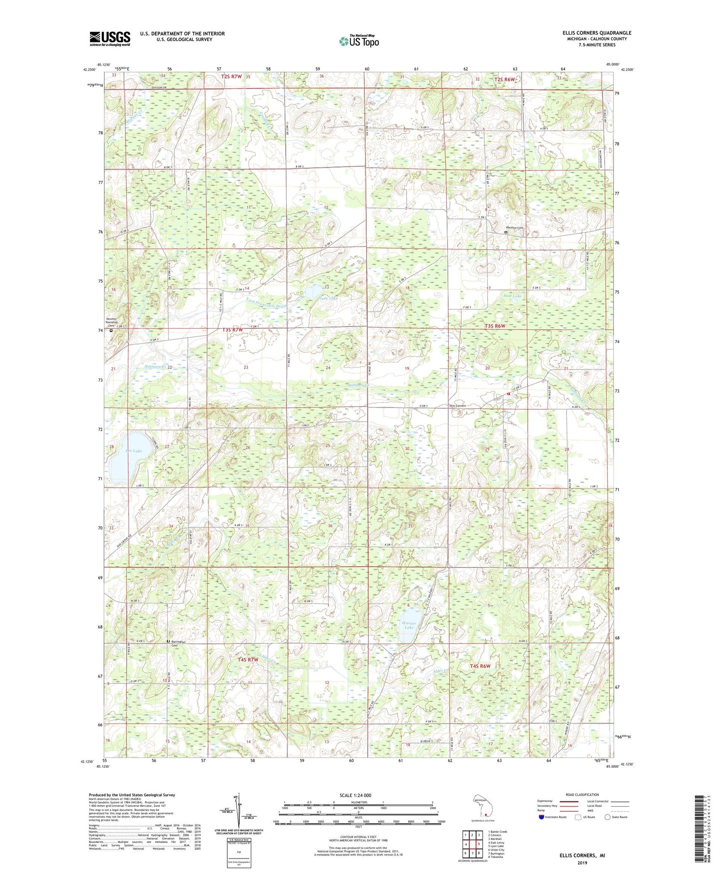
2019 topographic map quadrangle Ellis Corners in the state of Michigan. Scale: 1:24000. Based on the newly updated USGS 7.5' US Topo map series, this map is in the following counties: Calhoun. The map contains contour data, water features, and other items you are used to seeing on USGS maps, but also has updated roads and other features. This is the next generation of topographic maps. Printed on high-quality waterproof paper with UV fade-resistant inks.
Quads adjacent to this one:
West: East Leroy
Northwest: Battle Creek
North: Ceresco
Northeast: Marshall
East: Lyon Lake
Southeast: Tekonsha
South: Burlington
Southwest: Union City
Contains the following named places: Acker Extension Drain, Barrington Cemetery, Cain School, Calhoun County, Dodge School, Ellis Corners, Ellis Post Office, Francisco School, Fredonia Holiness Church, Fredonia Township Fire Department Station 2, Gleason Drain, Houston Cemetery, Houston School, Hyde Lake, Laurel Grove School, Lee Lake, Meyers School, Mud Creek, Newton Church, Newton Township Cemetery, Pierce School, Pout Lake, Salem Church, Tekonsha School, Township of Fredonia, Township of Newton, Underwood School, Warner Lake, Yost Francisco Drain, ZIP Codes: 49029, 49033