MyTopo
Evans Michigan US Topo Map
Couldn't load pickup availability
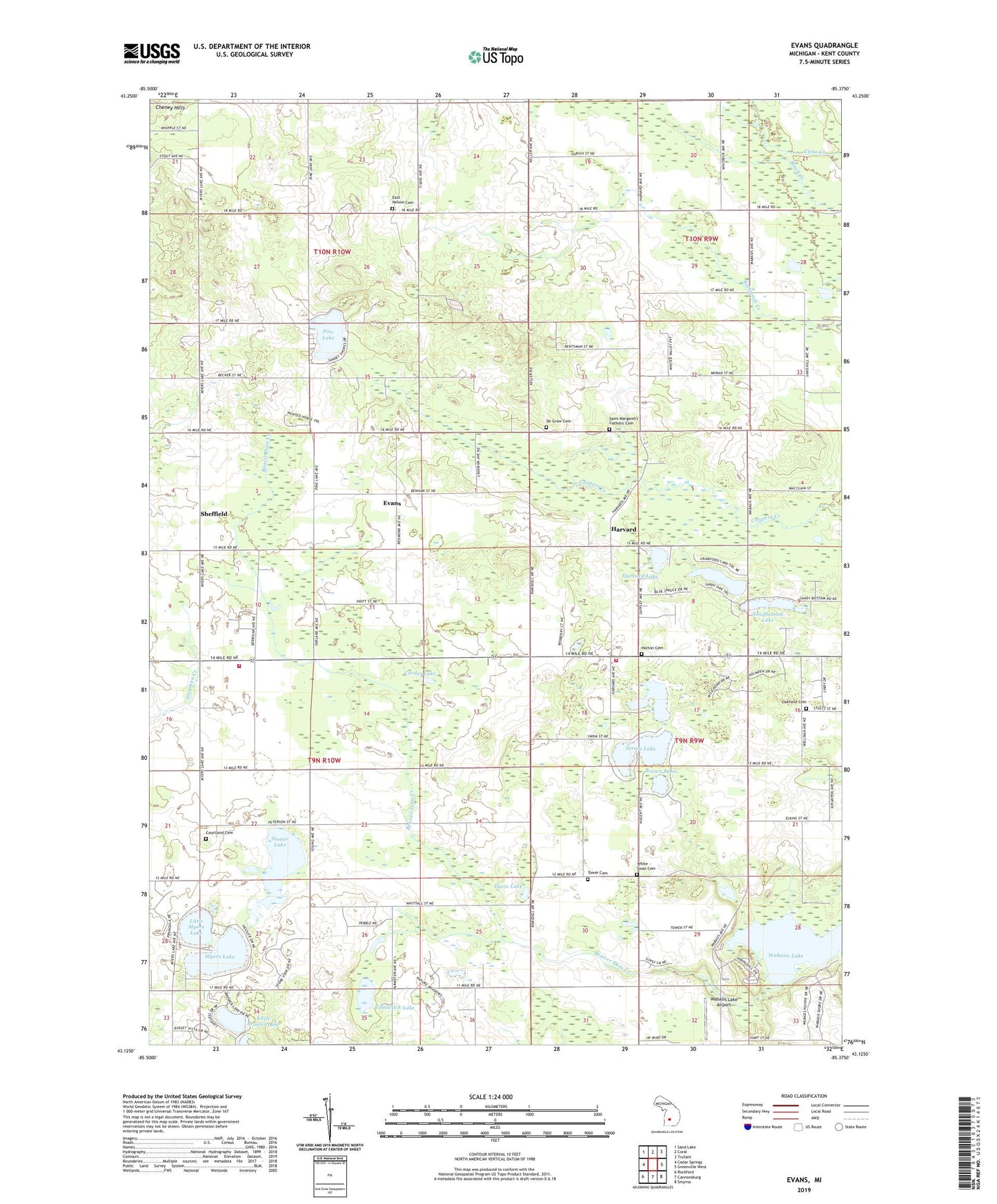
2023 topographic map quadrangle Evans in the state of Michigan. Scale: 1:24000. Based on the newly updated USGS 7.5' US Topo map series, this map is in the following counties: Kent. The map contains contour data, water features, and other items you are used to seeing on USGS maps, but also has updated roads and other features. This is the next generation of topographic maps. Printed on high-quality waterproof paper with UV fade-resistant inks.
Quads adjacent to this one:
West: Cedar Springs
Northwest: Sand Lake
North: Coral
Northeast: Trufant
East: Greenville West
Southeast: Smyrna
South: Cannonsburg
Southwest: Rockford
This map covers the same area as the classic USGS quad with code o43085b4.
Contains the following named places: Angel Lake, Beaver Dam Creek, Brown Lake, Cedar Chase Golf Club, Cordes Lake, Cortland Center Post Office, Cortland Post Office, Courtland Cemetery, Courtland Township Fire Department Station 1, Crawford Lake, Davis Lake, De Graw Cemetery, East Nelson Cemetery, Evans, Evans Post Office, Evans Station, Griswold Post Office, Harvard, Harvard Lake, Harvard Post Office, Harvard Station, Horton Cemetery, Little Brower Lake, Little Myers Lake, Myers Lake, Nelson Post Office, Oakfield Cemetery, Oakfield Church, Oakfield Township Fire Department, Pine Lake, Rockford Ambulance Courtland Substation, Saint Margaret Church, Saint Margaret's Catholic Cemetery, Sandbottom Lake, Scram Lake, Sheffield, Sheffield Post Office, Sheffield Station, Stoner Lake, Tamarack Lake, Tower Cemetery, Township of Courtland, United Methodist Church, Wabasis Lake, Wabasis Lake Airport, Wabasis Lake Park, Wabasis Park Campground, White Swan Cemetery, White Swan Post Office