MyTopo
Evans Creek Michigan US Topo Map
Couldn't load pickup availability
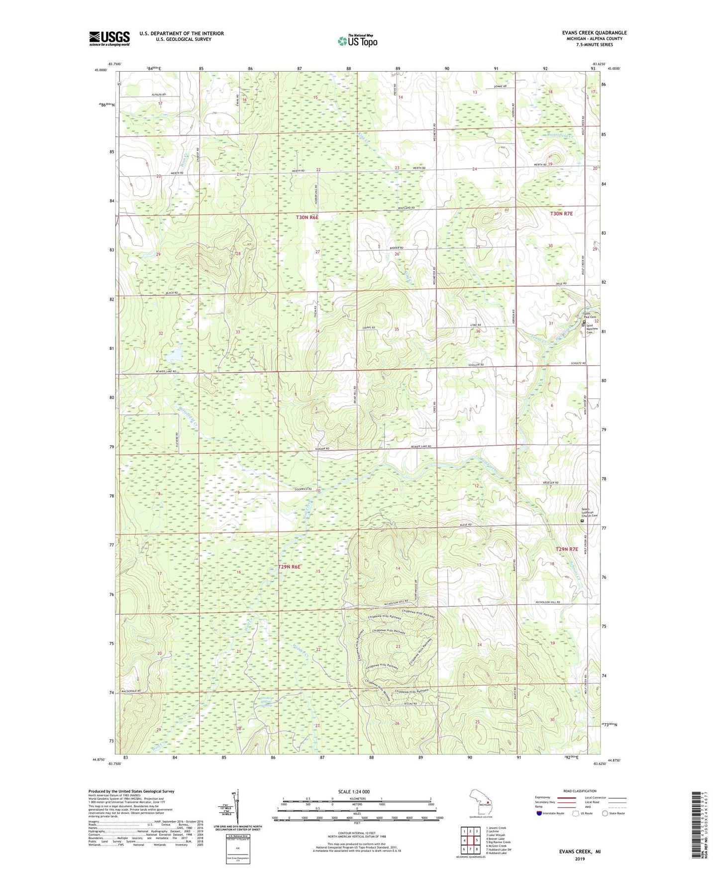
2023 topographic map quadrangle Evans Creek in the state of Michigan. Scale: 1:24000. Based on the newly updated USGS 7.5' US Topo map series, this map is in the following counties: Alpena. The map contains contour data, water features, and other items you are used to seeing on USGS maps, but also has updated roads and other features. This is the next generation of topographic maps. Printed on high-quality waterproof paper with UV fade-resistant inks.
Quads adjacent to this one:
West: Beaver Lake
Northwest: Jewett Creek
North: Lachine
Northeast: Lake Winyah
East: Big Ravine Creek
Southeast: Hubbard Lake
South: Hubbard Lake SW
Southwest: McGinn Creek
This map covers the same area as the classic USGS quad with code o44083h6.
Contains the following named places: Butterfield Creek, Evans Creek, Ossineke Township Hall, Saint Matthew Cemetery, Saint Matthew Church, Saint Paul Cemetery, Saint Paul Church, Salem Church, Salem Lutheran Church Cemetery, Schmitt Creek, Smokey Hollow Swamp, Township of Ossineke, Widner Creek, ZIP Code: 49744