MyTopo
Lachine Michigan US Topo Map
Couldn't load pickup availability
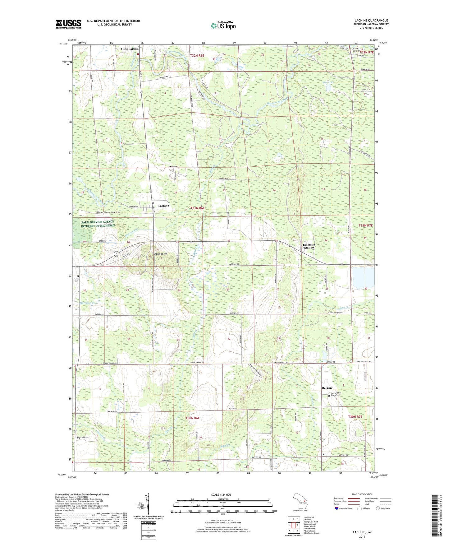
2023 topographic map quadrangle Lachine in the state of Michigan. Scale: 1:24000. Based on the newly updated USGS 7.5' US Topo map series, this map is in the following counties: Alpena. The map contains contour data, water features, and other items you are used to seeing on USGS maps, but also has updated roads and other features. This is the next generation of topographic maps. Printed on high-quality waterproof paper with UV fade-resistant inks.
Quads adjacent to this one:
West: Jewett Creek
Northwest: Hillman NE
North: Polaski
Northeast: Long Lake West
East: Lake Winyah
Southeast: Big Ravine Creek
South: Evans Creek
Southwest: Beaver Lake
This map covers the same area as the classic USGS quad with code o45083a6.
Contains the following named places: Bean Creek, Blue Lake, Community of Christ Church, Dafoe Post Office, Dafoe Station, Emerson Station, Flanders, Flanders Post Office, Gaffney Creek, Greely Baptist Church, Green Cemetery, Green School, Green Township Volunteer Fire Department, Herron, Herron Post Office, Herron Saint Rose's Cemetery, Lachine, Lachine Post Office, Liberty Baptist Church, Long Rapids School, Long Rapids Township Fire Department, Manning Hill, Manning Hill Park, Morrison Creek, Orchard Hill Bridge, Spratt, Spratt Creek, Spratt Post Office, WHSB-FM (Alpena), Wilson School