MyTopo
Faithorn Michigan US Topo Map
Couldn't load pickup availability
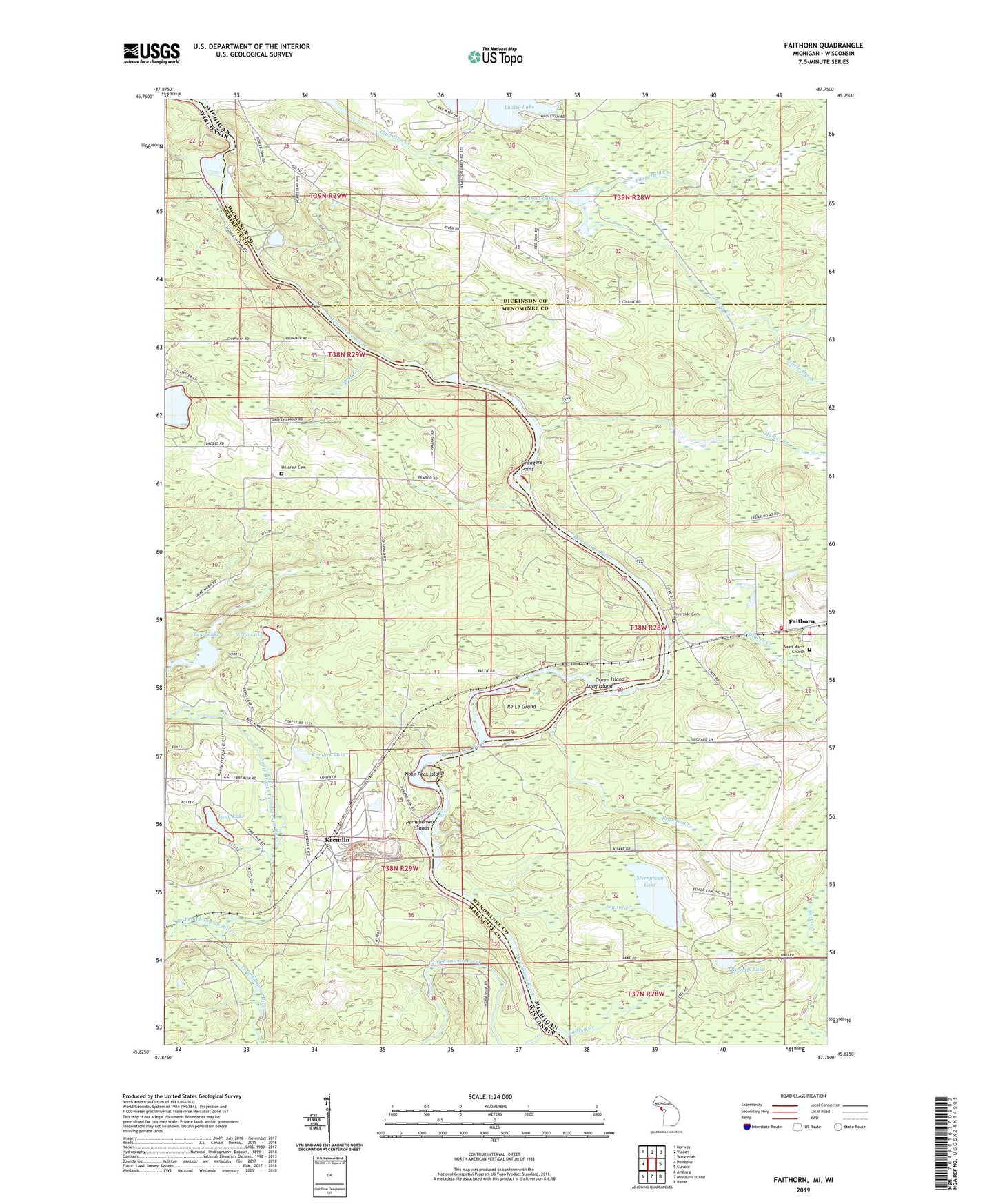
2023 topographic map quadrangle Faithorn in the states of Michigan, Wisconsin. Scale: 1:24000. Based on the newly updated USGS 7.5' US Topo map series, this map is in the following counties: Menominee, Marinette, Dickinson. The map contains contour data, water features, and other items you are used to seeing on USGS maps, but also has updated roads and other features. This is the next generation of topographic maps. Printed on high-quality waterproof paper with UV fade-resistant inks.
Quads adjacent to this one:
West: Pembine
Northwest: Norway
North: Vulcan
Northeast: Waucedah
East: Cunard
Southeast: Banat
South: Miscauno Island
Southwest: Amberg
Contains the following named places: Bear Creek, Brandts Creek, Brandts Lake, Chapman School, Earle Brook, Echo Lake, Emebonwon Dam, Faithorn, Faithorn Creek, Faithorn Post Office, Faithorn Rescue Squad, Faithorn Station, Faithorn Township Volunteer Fire Department, Faithorn Township Volunteer Fire Department Storage, Fitzgerald Creek, Grangers Point, Green Island, Harter Creek, Hillcrest Cemetery, Ile Le Grand, Kading Creek, Kimlark Lake, Kremlin, Lake Mary Park, Lake Shannon, Long Island, Long Lake, Louise Lake, Merryman Lake, Mission Chapel, North Branch Pemebonwon River, Nose Peak Island, Pemebonwon Dam, Pemebonwon Islands, Pemebonwon River, Quiver Falls, Red Dam Lake, Riverside Cemetery, Saint Mary's Church Cemetery, Seynor Creek, South Branch Pemebonwon River, Sturgeon Falls, Sturgeon Falls Flowage, Turners Creek, Twin Lake