MyTopo
Pembine Wisconsin US Topo Map
Couldn't load pickup availability
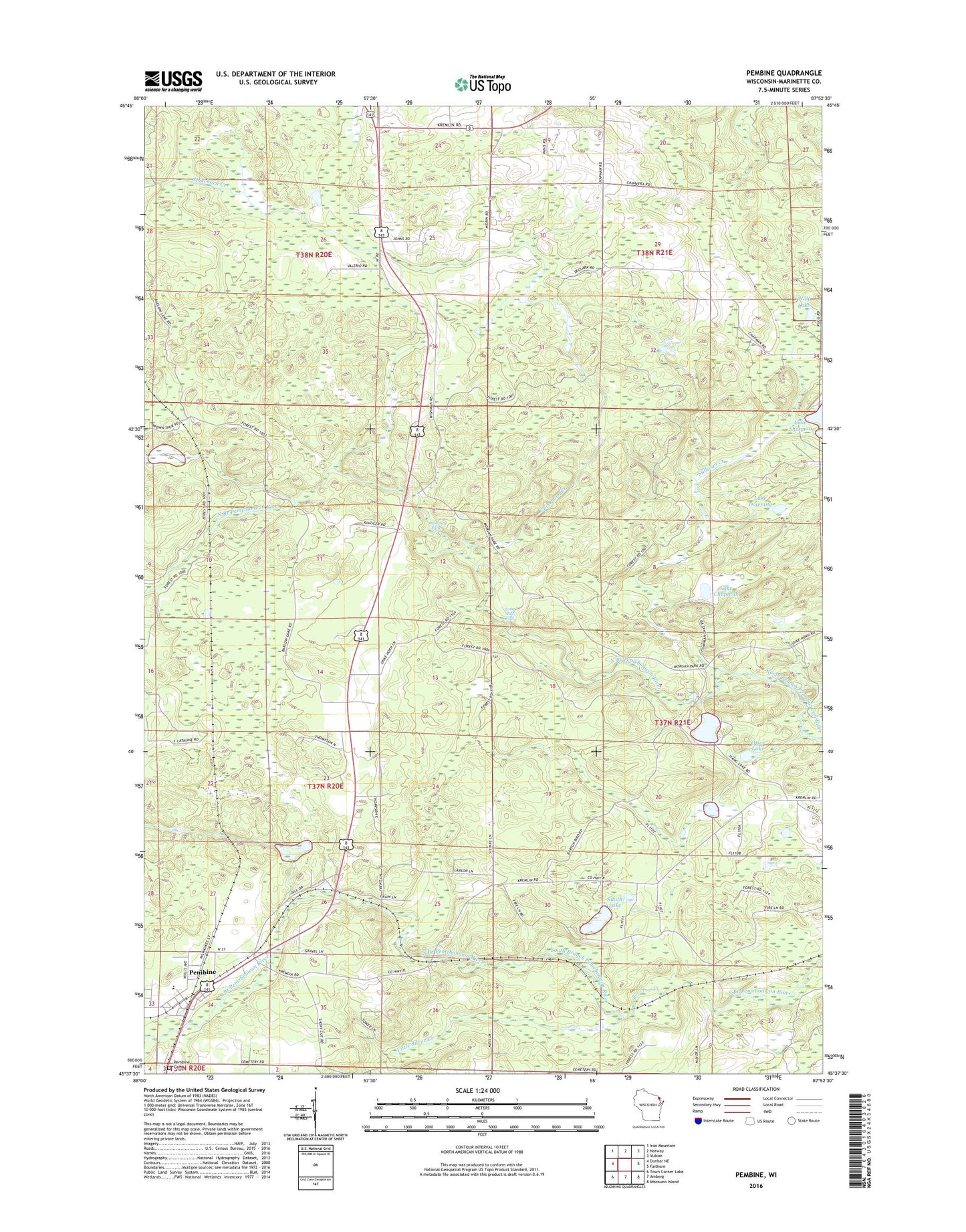
2022 topographic map quadrangle Pembine in the state of Wisconsin. Scale: 1:24000. Based on the newly updated USGS 7.5' US Topo map series, this map is in the following counties: Marinette. The map contains contour data, water features, and other items you are used to seeing on USGS maps, but also has updated roads and other features. This is the next generation of topographic maps. Printed on high-quality waterproof paper with UV fade-resistant inks.
Quads adjacent to this one:
West: Dunbar NE
Northwest: Iron Mountain
North: Norway
Northeast: Vulcan
East: Faithorn
Southeast: Miscauno Island
South: Amberg
Southwest: Town Corner Lake
This map covers the same area as the classic USGS quad with code o45087f8.
Contains the following named places: 1.35 Reservoir, 54151, Back Lake, Goldmeyer School, Joe Panis Jr E4083 Dam, Lake Chapman, Lake Downing, Little Silver Creek, Long Slide Falls, Long Slide Falls County Park, Maverick Field, Moreau School, Morgan County Park, Niagara Townhall, Otter Lake, Pembine, Pembine Cemetery, Pembine Census Designated Place, Pembine Elementary School, Pembine High School, Pembine Lookout Tower, Pembine Post Office, Rock Lake, Saint Margaret Church, Smalley Falls, Smith Lake, Spikehorn Creek, Sullivan Creek, Timms Lake, Town of Niagara, Town of Pembine, Wolf Lake