
MyTopo
Fletcher Michigan US Topo Map
Couldn't load pickup availability
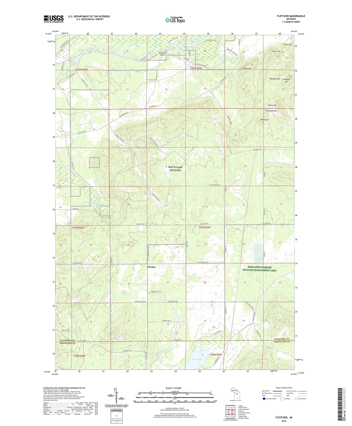
2019 topographic map quadrangle Fletcher in the state of Michigan. Scale: 1:24000. Based on the newly updated USGS 7.5' US Topo map series, this map is in the following counties: Kalkaska, Missaukee. The map contains contour data, water features, and other items you are used to seeing on USGS maps, but also has updated roads and other features. This is the next generation of topographic maps. Printed on high-quality waterproof paper with UV fade-resistant inks.
Quads adjacent to this one:
West: Sharon
Northwest: Sigma
North: Black Creek
Northeast: Lake Margrethe
East: Cote Dame Marie
Southeast: Meads Landing
South: Addis Creek
Southwest: Stittsville
Contains the following named places: Beecher Hill, Black Creek, Camp Grayling, CCC Bridge State Forest Campground, Clear Creek, Cleary Hill, Ester Hill, Fletcher, Fletcher Post Office, Fletcher School, Grass Lake, Grube Hill, Kalkaska State Forest, King Trout Airport, Lindquist Hill, Richards Hill, Smith Hill, Waldo Hill


