MyTopo
Black Creek Michigan US Topo Map
Couldn't load pickup availability
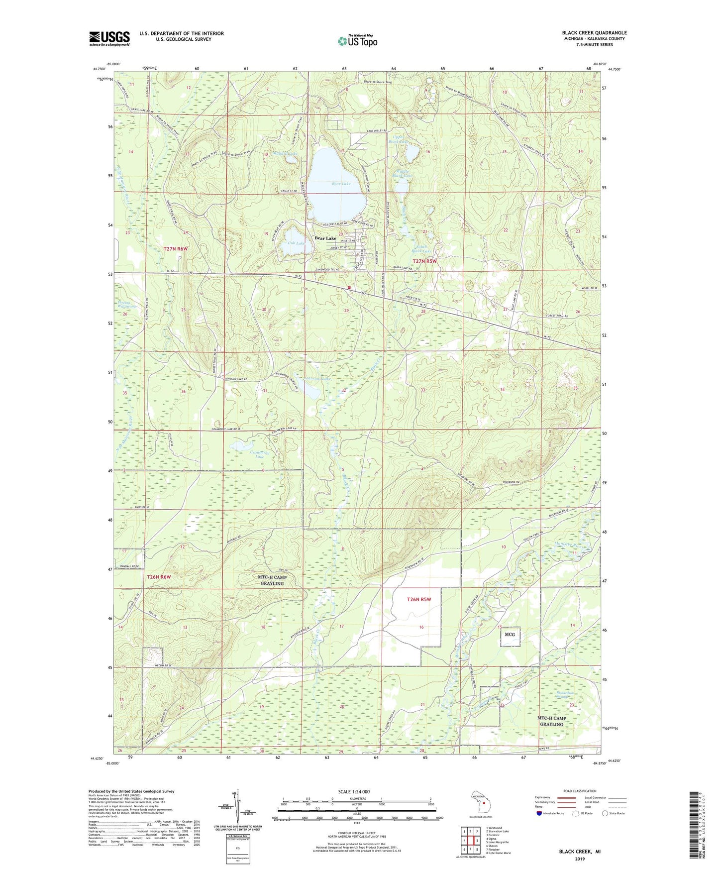
2023 topographic map quadrangle Black Creek in the state of Michigan. Scale: 1:24000. Based on the newly updated USGS 7.5' US Topo map series, this map is in the following counties: Kalkaska. The map contains contour data, water features, and other items you are used to seeing on USGS maps, but also has updated roads and other features. This is the next generation of topographic maps. Printed on high-quality waterproof paper with UV fade-resistant inks.
Quads adjacent to this one:
West: Sigma
Northwest: Westwood
North: Starvation Lake
Northeast: Frederic
East: Lake Margrethe
Southeast: Cote Dame Marie
South: Fletcher
Southwest: Sharon
This map covers the same area as the classic USGS quad with code o44084f8.
Contains the following named places: Bear Lake, Bear Lake Census Designated Place, Bear Lake Township Fire Department, Cranberry Lake, Cub Lake, Dowen Post Office, Johnsons Lake, Mallard Lake, Middle Black Lake, Pemberthy Crossing, Portage Creek, Richardson Swamp, South Black Lake, Township of Bear Lake, Upper Black Lake