MyTopo
Cote Dame Marie Michigan US Topo Map
Couldn't load pickup availability
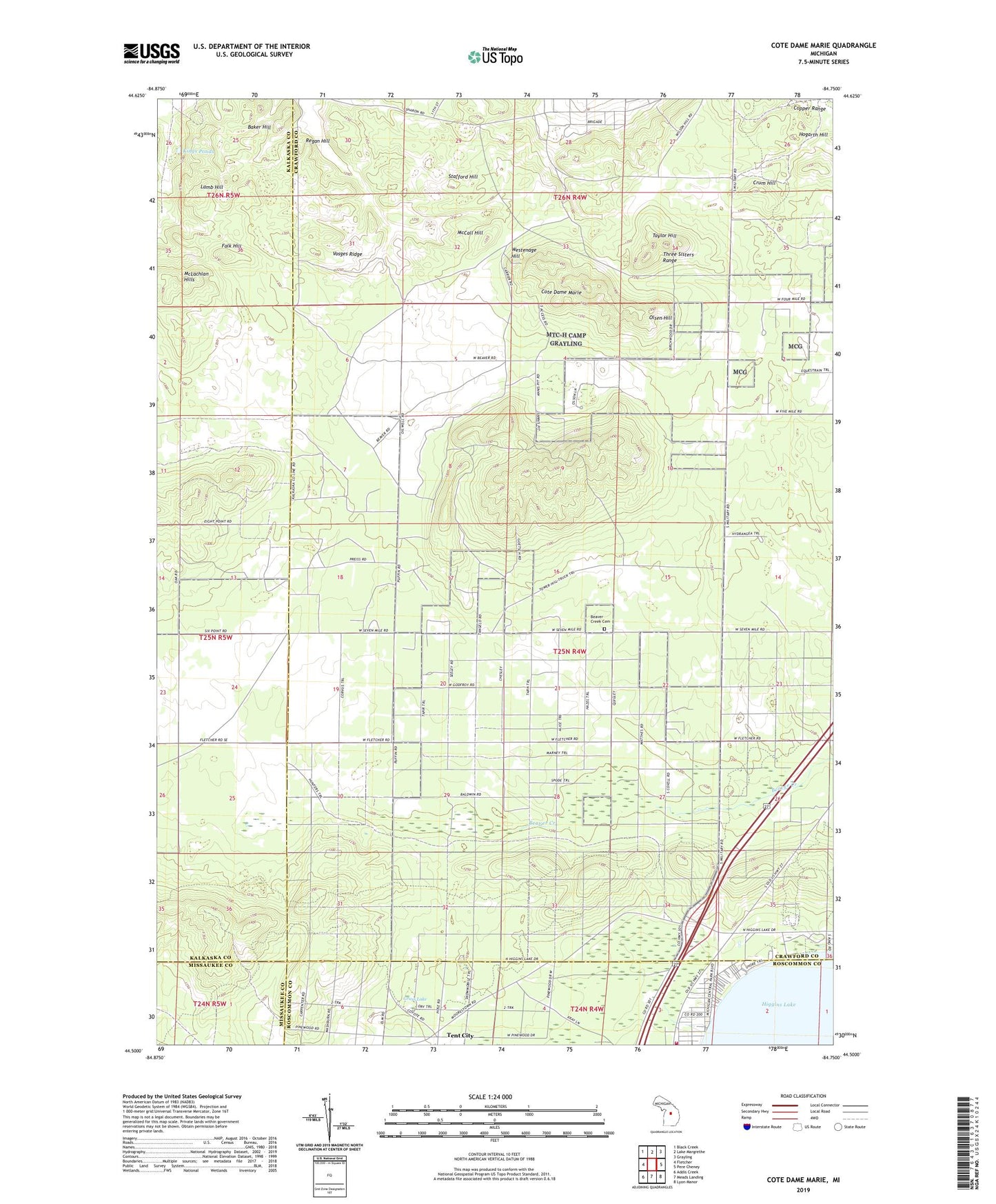
2023 topographic map quadrangle Cote Dame Marie in the state of Michigan. Scale: 1:24000. Based on the newly updated USGS 7.5' US Topo map series, this map is in the following counties: Crawford, Kalkaska, Roscommon, Missaukee. The map contains contour data, water features, and other items you are used to seeing on USGS maps, but also has updated roads and other features. This is the next generation of topographic maps. Printed on high-quality waterproof paper with UV fade-resistant inks.
Quads adjacent to this one:
West: Fletcher
Northwest: Black Creek
North: Lake Margrethe
Northeast: Grayling
East: Pere Cheney
Southeast: Lyon Manor
South: Meads Landing
Southwest: Addis Creek
This map covers the same area as the classic USGS quad with code o44084e7.
Contains the following named places: American Legion Park, Baker Hill, Beaver Creek Cemetery, Beaver Creek School, Beginning of State Reforestation Historical Marker, Civilian Conservation Corps Museum, Copper Range, Cote Dame Marie, Crum Hill, Falk Hill, Grass Lake, Grass Lake Lookout Tower, Higgins Lake State Nursery, Kings Ponds, Lamb Hill, McCall Hill, McLachlan Hills, North Higgins Lake State Park, North Higgins Lake State Park East Campground, North Higgins Lake State Park West Campground, Officer's Club Historical Marker, Olsen Hill, Portage Lake Lookout Tower, Regan Hill, Stafford Hill, Taylor Hill, Tent City, Three Sisters Range, Vosges Ridge, Wellington Farm Park, Wellington Post Office, Westenage Hill