MyTopo
Addis Creek Michigan US Topo Map
Couldn't load pickup availability
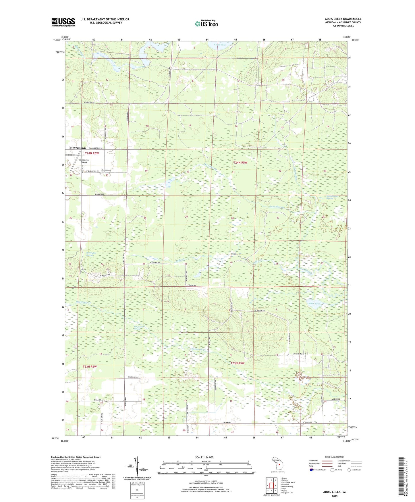
2023 topographic map quadrangle Addis Creek in the state of Michigan. Scale: 1:24000. Based on the newly updated USGS 7.5' US Topo map series, this map is in the following counties: Missaukee. The map contains contour data, water features, and other items you are used to seeing on USGS maps, but also has updated roads and other features. This is the next generation of topographic maps. Printed on high-quality waterproof paper with UV fade-resistant inks.
Quads adjacent to this one:
West: Stittsville
Northwest: Sharon
North: Fletcher
Northeast: Cote Dame Marie
East: Meads Landing
Southeast: Houghton Lake
South: Merritt
Southwest: Dinca
This map covers the same area as the classic USGS quad with code o44084d8.
Contains the following named places: Addis Creek, Bear Lake, Big Cannon Creek Number One Flooding, Big Cannon Creek Number Two Flooding, Big Cannon Creek Swamp, Dead Stream Swamp, Enterprise Oil Field, Haymarsh Swamp, Moorestown Airpark, Moorestown Cemetery, Norwich Oil Field, Pownell Landing Strip, Remington Swamp, Stratford Dam, Township of Enterprise, Township of Norwich, Willow Run