MyTopo
Lake Margrethe Michigan US Topo Map
Couldn't load pickup availability
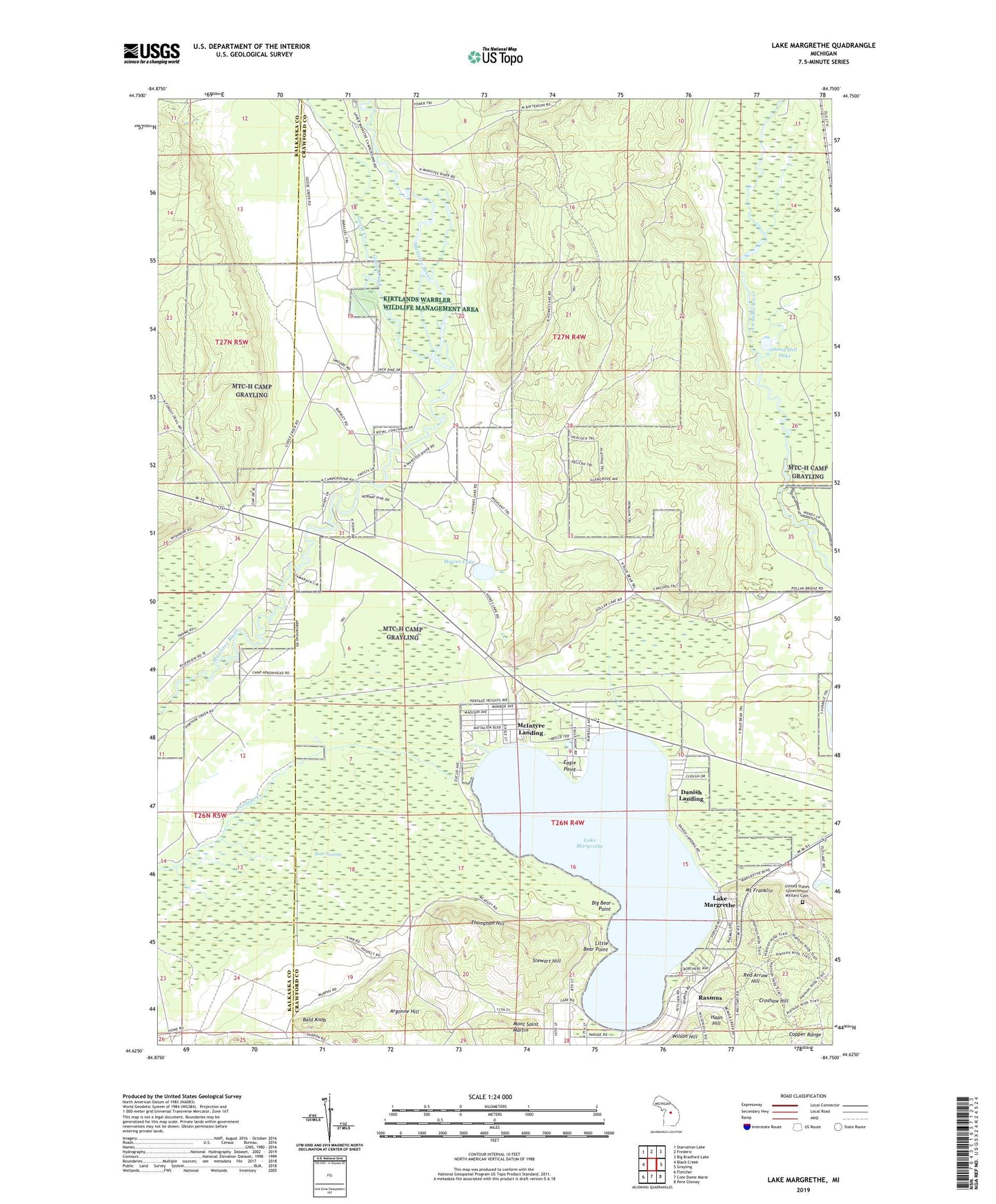
2023 topographic map quadrangle Lake Margrethe in the state of Michigan. Scale: 1:24000. Based on the newly updated USGS 7.5' US Topo map series, this map is in the following counties: Crawford, Kalkaska. The map contains contour data, water features, and other items you are used to seeing on USGS maps, but also has updated roads and other features. This is the next generation of topographic maps. Printed on high-quality waterproof paper with UV fade-resistant inks.
Quads adjacent to this one:
West: Black Creek
Northwest: Starvation Lake
North: Frederic
Northeast: Big Bradford Lake
East: Grayling
Southeast: Pere Cheney
South: Cote Dame Marie
Southwest: Fletcher
This map covers the same area as the classic USGS quad with code o44084f7.
Contains the following named places: Argonne Hill, Bald Knob, Bear Swamp, Big Bear Point, Camp Arrowhead, Camp Grayling, Collens Landing, Croshaw Hill, Danish Landing, Eagle Point, Goose Creek, Grayling Winter Recreation Area, Haan Hill, Hanson State Game Refuge, Howes Lake, Lake Margrethe, Lake Margrethe State Forest Campground, Little Bear Point, Manistee River Bridge State Forest Campground, McIntyre Landing, Mont Saint Martin, Mount Franklin, Rasmus, Red Arrow Hill, Sand Hill Lake, Stewart Hill, Thirty-Second Red Arrow Division Historical Marker, Thompson Hill, United States Government Military Cemetery, Upper Manistee River State Forest Campground, Wilson Hill