MyTopo
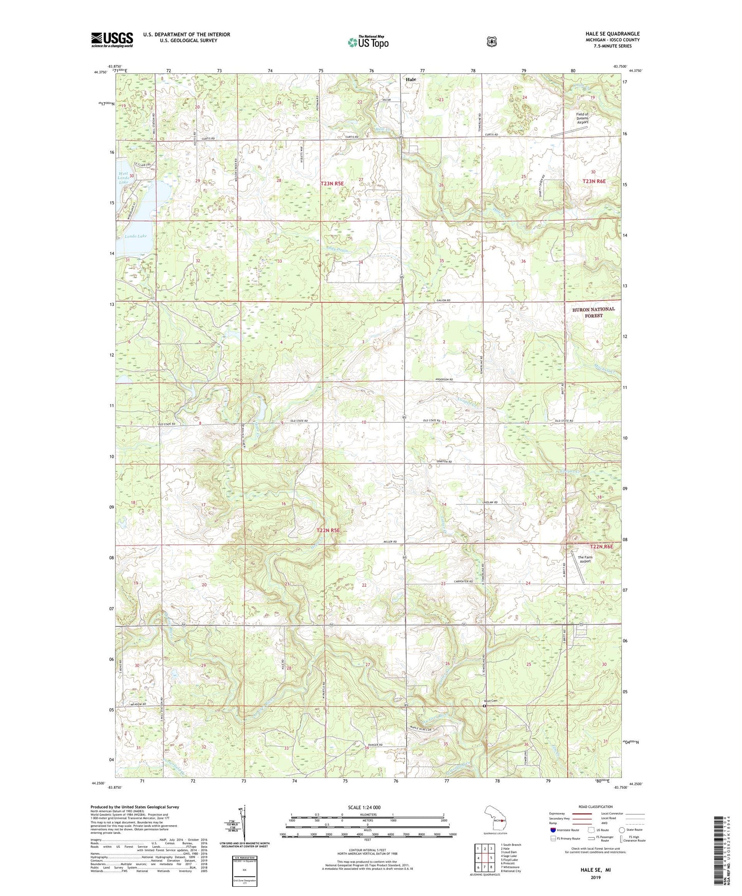
Hale SE Michigan US Topo Map
Couldn't load pickup availability
Also explore the Hale SE Forest Service Topo of this same quad for updated USFS data
2023 topographic map quadrangle Hale SE in the state of Michigan. Scale: 1:24000. Based on the newly updated USGS 7.5' US Topo map series, this map is in the following counties: Iosco. The map contains contour data, water features, and other items you are used to seeing on USGS maps, but also has updated roads and other features. This is the next generation of topographic maps. Printed on high-quality waterproof paper with UV fade-resistant inks.
Quads adjacent to this one:
West: Sage Lake
Northwest: South Branch
North: Hale
Northeast: Loud Dam
East: Floyd Lake
Southeast: National City
South: Whittemore
Southwest: Prescott
This map covers the same area as the classic USGS quad with code o44083c7.
Contains the following named places: Addy Drain, Field of Dreams Airport, Hale Lookout Tower, Hope Creek, Latter Creek, Londo Lake, Porterfield Creek, Reno Cemetery, Reno Church, Saint Paul's Lutheran Church, Siloam Post Office, The Farm Airport, Township of Reno, ZIP Codes: 48739, 48770